Spent the day catching up with Katie Masleid, an old friend from Pflugerville, TX who now lives south of San Jose. Met up with her and her boy Rob, got a little lunch in Los Gatos at a cafe called Sweet Pea’s that makes sweet and savory crepes. I went with savory: shrimp and avocado.
From there we travelled to Castle Rock State Park. The big hit along the way (at least for me) was the fancy GPS navigation system. So cool.
We hiked around for a few hours, got a look at some cool rock formations, of which the photo above is one—the “HR Giger-esque” underside of a formation known as “Castle Rock.” The white spots are chalk left behind by rock climbers. We got to watch a few guys trying to climb a different overhang with only a few pads they’d brought in (and each other) to break their falls. And they did fall. We left when one appeared to have wrenched his ankle pretty bad.
Finally we got out to what we think was the “Goat Rock.” We saw many creatures in the rock formations during the hike, (turtles, dinosaurs) but I had a hard time finding a goat in the rock that I took this picture on, of what I believe are the Santa Cruz Mountains in the distance.
After the hike we got back and grilled some pre-marinated tri-tip (think mini-brisket), corn on the cob, asparagus, and we gorged on chips and salsa. It was all wunderbar. And so nice to see someone I hadn’t seen in over 7 years.
i traveled down to the city sunday morning to meet up with my cousin christy and her partner marcus. traffic was light, got there in just about an hour. they live in the castro, which i had only heard about the night before from alice who was telling me about morgan spurlock’s new show, 30 days. in one episode he has a conservative christian from michigan live with a gay man in the castro for 30 days.
from there we headed down along the san mateo coast for about an hour till we got to butano state park, just south of half moon bay. the fickle summer weather was on our side as the views were tremendous, especially around pacifica. the fog stayed several miles off the coast (until the drive home). we hiked for a few hours through a redwood canyon, which was nice, with a particularly steep decent towards the end.
justin at butano
afterwards we stopped at duarte’s in pescadero for some artichoke soup and dungeness crab. by the time we left, a dense white fog had swept over the coast, providing a much different drive back to san francisco.
i tried to help christy getting her wireless connection working to no avail. chatted for a while about the area—now i’ve got a mental list of places to visit, including the pinnacles and point lobos. headed home just after the sun had set, and snapped this neat blurry picture of the golden gate bridge.
yesterday i wanted to go riding around on my bike. i haven’t in a while since i drive to work now. i found a trail that runs along the santa rosa creek from downtown to fulton road, which is way out on the west side of town.
zion came highly recommended. in fact at that communal dinner i had in santa fe, it was even recommended that i hike two trails specifically, one with three levels of waterfalls cascading off of steep walls, and one called angel’s landing where there’s a section of the hike only a few feet wide with sheer dropoffs on either side.
whereas with the grand canyon you start at the top, with zion, you start at the bottom and can actually drive through the narrow canyon, created by the virgin river, which due to all the recent rainful, was raging. however parking in the canyon is limited, so there’s a shuttle service from the super cute town just outside the park to the front gate.
then from that point there’s a shuttle that runs the entire length of the canyon, alongside the river. i got off at the stop for the emerald pools trailhead, hiked it one direction, then hiked up to the middle and upper pools. this is a view of the canyon on the way to the middle pool.
here i am standing at the egde of the middle pool. though you can see some bit of green algae along the edges of the water as it cascades down to the lower pool, at this time of year the water looks more olive than emerald.
that was pretty easy and not all that spectacular, so i decided to kick things up a notch. i caught the shuttle up to the stop for the angel’s landing trailhead, which was advertised as “strenuous” with “long drop-offs and narrow trail. not for anyone fearful of heights.” it ascends 1488 feet from the canyon floor and the last half mile of the 2.5 mile trail “follows steep narrow ridge; chains have been added.” sign me up! i say.
this trail started ascending very quickly, with short, tight switchbacks. here’s a view looking down the canyon to the south.
finally, after an incredible series of 21 switchbacks stacked right on top of each other (known as walter’s wiggles), i emerged on top. or so i thought.
the following picture best expresses angel’s landing. that is the remaining half mile of the trail. a narrow ridge of rock, 1400 feet off the canyon floor, a portion of it ascending at a 45 degree angle with the goal beyond the highest ridge in the foreground. looking at it from this perspective, it’s hard to imagine it was even possible. my only consolation was seeing these tiny little people scrambling at various points along the ridge. if they could do it, so could i.
and this is me at the top!
finally here’s an unobstructed view from the pinnacle of angel’s landing.
surprisingly, going back down the ridge, one hand on chain, butt dragging along rock, was a lot easier than going up. i think it was around 7pm when i finally made it back to the entrance of the park. i decided rather than try to drive to salt lake city in the dark and miss out on the “countryside,” i found a hotel in hurricane for the night—a much easier task on a sunday—to rest after two straight days of strenuous hikes and to catch up on my blogging.
as i drove back to the grand canyon from williams, i flipped on the radio for the first time this trip and eventually stumbled upon npr doing a piece about blind tibetan teenagers attempting to climb a himalayan peak. how humbling i thought later. and how appropriate. i got to the grand canyon, paid for a year long national park pass. got a map and a newspaper guide. knew i wanted to hike, but didn’t know where.
there’s a rim trail, which wanders around the rim, but i didn’t want to stay at the top of the canyon, i wanted to go down in. however in my meager research the night before, i discovered that it takes two days to go from the rim to the colorado river and back again. they seemed pretty serious. i certainly didn’t want this happening to me. since i thought hiking down to the colorado river was the whole point, and since i wasn’t prepared for any kind of camping, i was unsure of what to do.
eventually i realized there were trails that went into the canyon but not all the way to the river, so i settled on the bright angel trail, mostly because i could identify it clearly on a number of maps. it started nearby, and was composed of several segments, the longest of which was estimated to take 8-12 hours round trip (12.2 mi!). well, i had the whole day, so i figured i’d see how i felt at each checkpoint and determine whether to turn around or keep going.
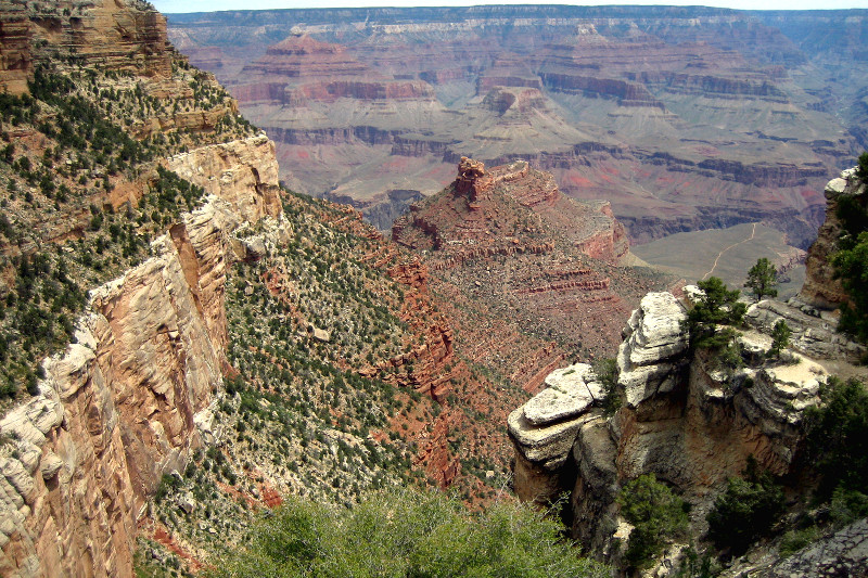
this is what the grand canyon looks like from the bright angel trailhead. the day started out overcast, which made everything look kind of gray. also worth noting is the vegetation in and on the canyon. i was told that the southwest has seen record levels of rainfall this spring, so apparently everything is denser and greener than it has been in 10 years.
view from the bright angel trailhead
i hiked down and down and down. in the beginning i “ran” it, until my feet felt like they were on fire. since i had been thinking “trail running,” i wore running socks, which are quite thin, even though i had thick, synthetic wool hiking socks in my suitcase. oops. slight miscalculation.
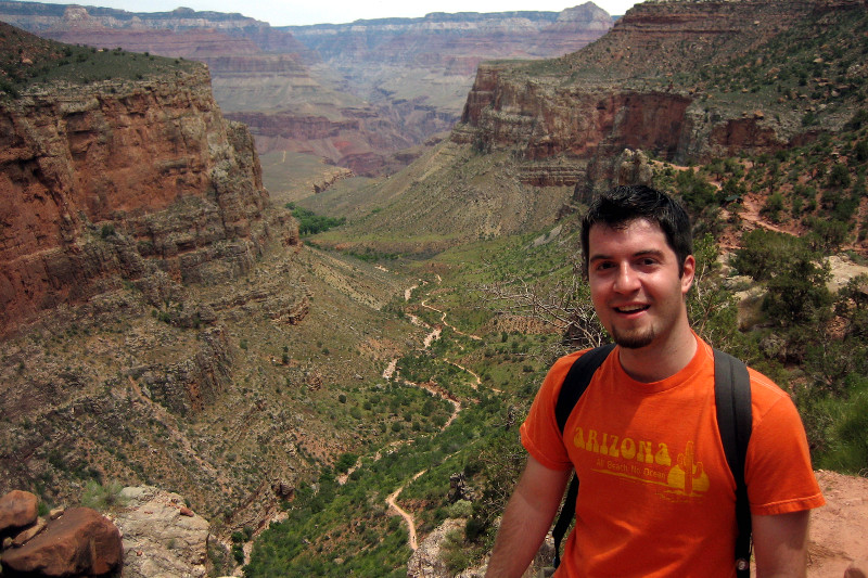
i kept going down and down, eventually covering 4.6 miles, descending 3060 feet into the grand canyon when i made it to the last checkpoint before the end of the trail, called indian garden. here i refilled my water and decided whether to take the last leg, a 1.5 mile hike along a relatively flat plateau, presumably with stellar views of the “inner canyon.” are you kidding me? hell yeah!
justin with indian garden and plateau point in the distance
to my bemusement, the clouds began to break, promising better pictures, but a hotter justin. it’s also quite a bit warmer in the canyon. at some point in the middle of the plateau, i turned around and snapped this shot looking back from whence i came. at no point in the course of this hike had i thought one iota about hiking back up out of the canyon.
looking back from whence i came
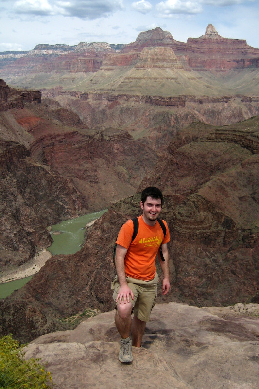
finally success is mine! the colorado river in sight!
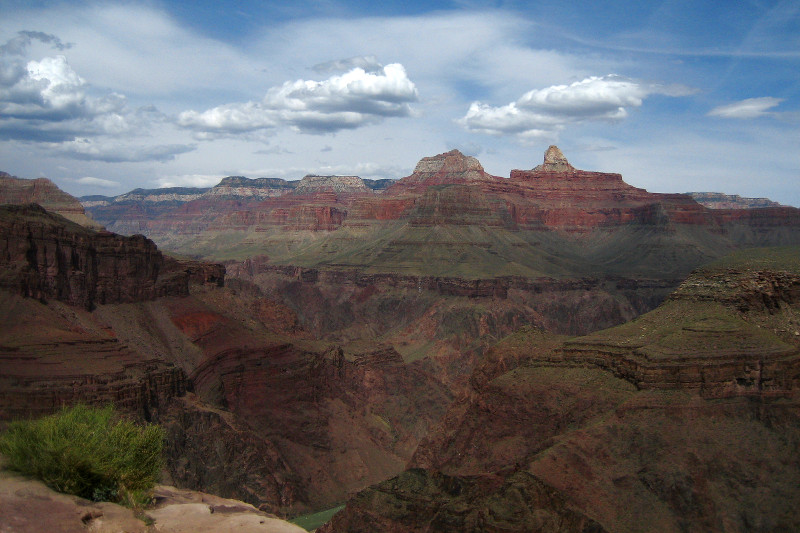
the colorado in sight!one last beautiful view of the grand canyon from plateau point
suffice it to say, it took a lot longer getting out of the canyon than it took getting in. i think i started a little before 11am and estimate that i got to the plateau point around 2. i emerged from the grand canyon 5 hours after that. a good bit of the last part i was walking like an old man, a few inches at a time.
my legs and shoes were caked with red dust and sand. my feet were blistered. my back ached and my quadriceps screamed. i was limping. i could barely take a full breath without triggering a cough reflex. it was SO awesome.
view from the trailhead before hobbling back to my car