so if I were to appear on your doorstep in a couple of days for a few days what type of impact would that be to your lifestyle
Heh. No problem! Fast forward to Saturday at noon, and I get a call from my dad. “So which apartment number are you?” Apparently he found my doorstep, having come all the way from Texas no less.
On Saturday Stephanie, my dad, and I drove out 116 to Jenner, then further up CA-1 than I’ve ever been to Salt Point State Park, known for providing the sandstone for “San Francisco’s streets and buildings during the mid 1800’s.” The weather was inexplicably clear. The fog stayed way off in the distance all day.
At several points along CA-1 we got out to admire the view (and to give dad a chance to regain his land legs—he gets the willies around steep heights). Here’s a view looking due west just north of Jenner.
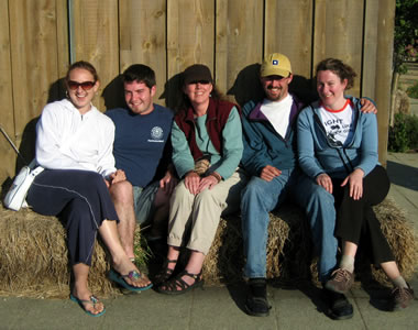
Later we stopped again and took a group shot.
We were a little confused about the park’s main entrance (it’s the one marked Gerstle Cove Campground), but eventually made it to Salt Point in the early afternoon. The wind was blowing at a decent clip, so we all put on 3+ layers and began hiking along the Salt Point trail towards Stump Beach Cove.
Occasionally we’d stop to explore the rocky landscape.
Here I decided to climb jump around on some big rocks (photo credit: Stephanie).
Neat erosion pattern called tafoni, thought to be caused by the salt and moisture in the wind alternately strengthening and weakening the sandstone.
Though only marked as 1.2 miles on the trail map (that we conveniently took a picture of at the park entrance for reference along the way) with the wind blowing against us, and no signage assuring that we were on the right path, it felt like we were walking forever. Eventually we made it to the blue green waters of Stump Beach Cove, where despite the constant wind, there were several dozen people hunkered down on the beach.
After a brief jaunt on the shoulder of CA-1, we looped back around on the North Trail, which was a less windy, much warmer hike. Toward the end the trail got pretty medieval. We could have used a machete.
Stephanie had driving duty on the way back home and more importantly, toward food. We opted for the single-lane mountain road experience, in the form of Fort Ross Road, all the way through Cazadero and back down to 116. Not a drive for the weak of constitution.
We turned towards Guerneville for dinner, stopping at the first place we saw (not counting the only chinese food place in town) called the Roadhouse Restaurant and Bar at Dawn Ranch Lodge (nee Fifes Resort). The crabcake appetizers were tasty, I had a filet mignon topped with bleu cheese, dad had a pepper-crusted steak, and Stephanie had basil-stuffed gnocchi, all of which were quite excellent. We drank wine, we talked, and when it came time to head home, it was only because we were all thoroughly exhausted.
On Sunday Stephanie and I made it out to the Russian River (my first time) to do a little afternoon paddling. I’ve spent a fair amount of time in a kayak, but I can only remember ever being in a canoe out on Wappinger Lake when I lived in Poughkeepsie.
We arrived at River’s Edge Kayak and Canoe Trips in Healdsburg around 2, pretty much at the last moment possible to start a 2-3 hour half day trip. Boarded their old-skool Blue Bird school bus and took it up to the launch point at Rio Lindo, which for the last mile went off-road, down a hill and through an apple orchard.
We used our life preservers as seat cushions (the Russian River is only knee to waist deep) brought along a cooler full of goodies, and began our long slow paddle down the meandering river. There were a few excellent moments one might call “rapids” where the river narrowed, changed directions, and dropped elevation, but for the most part it was a gentle, go-with-the-flow, stick your feet in the water kind of time.
On Sunday we got the gang together for a spur-of-the-moment outing to Angel Island State Park. As has been our luck lately, the day was quite sunny and clear.
The island is accessible only by ferry, which runs every hour from 10 till 5pm on the weekends. We made it in time for the 2pm ferry, which gave us a little under three hours to explore.
Route of the Tiburon-Angel Island ferry
Of course no one wants to miss the last ferry leaving the island (at 5:20pm) so we were a bit more conservative in our hiking than we otherwise might have been. That said, looping a third of the way around the island, checking out the abandoned shell of a WWI-vintage military hospital, and then hoofin’ it back again was pretty exhausting, especially given the persistent sun.
Panorama of the island as seen from the ferry
Note: I updated my stylesheet to give the photo above a horizontal scrollbar. If it’s stretching out the post, you might have to do a hard reload by pressing Ctrl+Shift+R.
From the island, here’s the view back towards Tiburon and Belvedere.
Tiburon and Belvedere
Angel Island is positioned such that it affords glimpses of all three major bridges that traverse the Bay (on a clear day).
Here’s the Golden Gate Bridge, actually taken from the ferry.
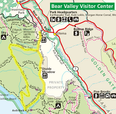
On Monday morning Stephanie and I went out to Point Reyes to see my second cousin Art and his girlfriend Martha who’d flown into town from DC, visiting two of their friends (recent bay area transplants) and Art’s sister Christy. We all arrived at the Bear Valley Visitor Center and planned a three hour round trip hike out to the coast. The seven of us tromped off, taking a loop that started on the Meadow Trail, then went along the Sky Trail ridge towards Arch Rock, and then back along the Bear Valley Trail.
We quickly discovered that the Meadow Trail is gross misnomer. It’s not a hike through a meadow. It’s a hike to a meadow. At the top of a mountain. An alpine meadow if you will. If you can tell by the parallel Mt. Wittenberg Trail, we were ascending roughly 1400′ in a relatively short distance.
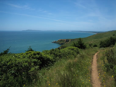
After a long hike on the Sky Trail, we finally emerged to stunning views of Point Reyes reaching out into the ocean.
At one point we just sat ourselves down to marvel at its rich blueness. And to refuel. For a place that’s supposed to have some of the worst weather along the coast, I just keep getting lucky.
Below is a view of the trail approaching Arch Rock. The arch is actually under the path ahead, where the people in the distance are.
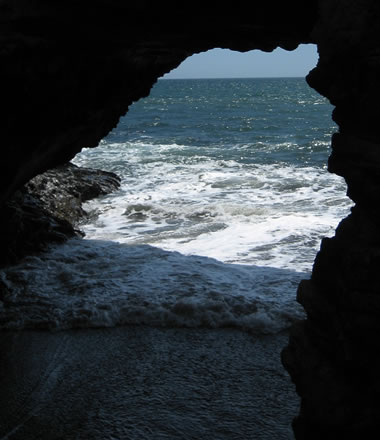
Of course I climbed down to snap a shot of the hole that’s been drilled through the rock by the Coast Creek rushing out of the hills.
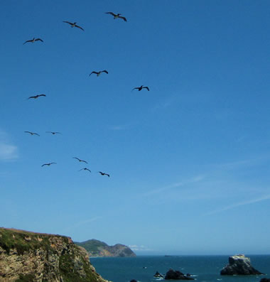
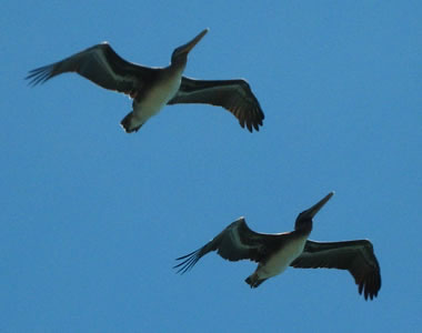
We also saw several flocks of what I believe were pelicans flying right over us.
Ok, so maybe three hours was a little ambitious. With two short breaks, I think we made our way back in a little over four hours. or was it five? I dunno. There definitely was some soreness in the feet going on. But there also was a lot of looking forward to that beer we were going to have once we made it out. After going over a more detailed trail map, I calculated that we hiked about 10.8 miles.
For food we found a cute taqueria-cum-tex-mex restaurant in Point Reyes Station called Rosie’s Cowboy Grill. I had a chicken taco and a bowl of real texas style chili. Half the table got fancy chili rellenos. Everyone seemed very happy. Afterwards we all departed on our respective ways, but not before I gathered the group for a photo.
Stephanie, Justin, Christy, Art, Martha
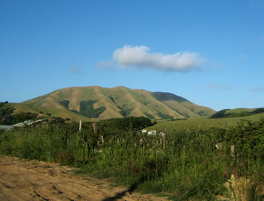
Here’s a bonus shot I took of Black Mountain on the drive home. It’s always been instantly recognizable to me after someone (probably Terrie) described it as looking like the knuckles of a fist sticking out of the ground. Nice image.
A lot of people know that the grass in California is green during the winter rain, and golden yellow the rest of the year. And at some point that change has to happen. Well right now it’s in that transition to yellow.
I think I’ve perfected the art of spontaneous activity. It sort of goes like this.
Wake up very leisurely. Weather is overcast but not raining, the forecasted precipitation having postponed the camping trip planned for this weekend. So no plans. Something about boating creeps into my head, and the thought that if it’s a little sprinkly out, the one place to be is outside on the water.
Suggest to Stephanie that we go kayaking (still having a discount to use after my basic kayaking skills class). Discover she’s a little hesitant about water depth, and wide open expanses of ocean while being enclosed in a small boat, and sharks. I cajole, so she commits to give it a shot.
We get to Blue Waters in Marshall a little before 3 (this is important, because they close at 5), and the clouds have quite literally opened up above Tomales Bay. It’s warm out. The water is relatively calm. No one else is around. Get suited up, and we’re off, sans wet suits cause we’re in a closed-deck kayak, no sharks in site. Now where to go? We start heading south, into the wind before deciding to jet across the bay towards some cliffs covered with red algae. The gmaps pedometer says we probably paddled about 1.5 miles.
Disembark on the beach for snacks and exploring. Discover some massive brown jellyfish (probably sea nettles?) that have been washed ashore.
Justin, Banana, Kayak
Stephanie, Banana, Kayak
Yeah, so those pictures taken of us are on the Point Reyes side, with the California coast mainland (where we paddled from) in the background. By the time we left the beach it was after 4(!) and we need to get back before they close, so we motored across the bay, this time with the wind, making it in about half an hour.
BUT! The day of spontaneity wasn’t over yet. After a cup of chowder at the Marshall General Store, we stopped in at the Hog Island Oyster Company (well after they’d closed) and managed to pick up two dozen medium oysters for some barbecuing later…
So we got in touch with Mark, Marcia, and spent the rest of the evening at Mark’s brother’s place in Graton, drinking beer, shucking oysters, grilling meats and vegetables. On top of it all, roasting some marshmallows over the remaining coals. Got back home around midnight. Stuffed.