Hiking Point Reyes with Christy and Art
On Monday morning Stephanie and I went out to Point Reyes to see my second cousin Art and his girlfriend Martha who’d flown into town from DC, visiting two of their friends (recent bay area transplants) and Art’s sister Christy. We all arrived at the Bear Valley Visitor Center and planned a three hour round trip hike out to the coast. The seven of us tromped off, taking a loop that started on the Meadow Trail, then went along the Sky Trail ridge towards Arch Rock, and then back along the Bear Valley Trail.
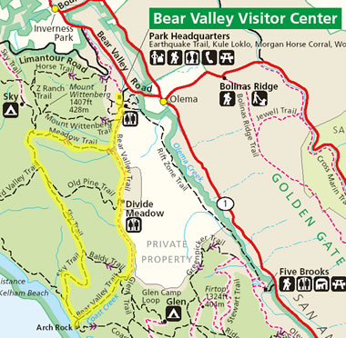
We quickly discovered that the Meadow Trail is gross misnomer. It’s not a hike through a meadow. It’s a hike to a meadow. At the top of a mountain. An alpine meadow if you will. If you can tell by the parallel Mt. Wittenberg Trail, we were ascending roughly 1400′ in a relatively short distance.
After a long hike on the Sky Trail, we finally emerged to stunning views of Point Reyes reaching out into the ocean.
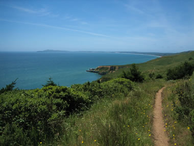
At one point we just sat ourselves down to marvel at its rich blueness. And to refuel. For a place that’s supposed to have some of the worst weather along the coast, I just keep getting lucky.
Below is a view of the trail approaching Arch Rock. The arch is actually under the path ahead, where the people in the distance are.

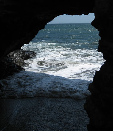
Of course I climbed down to snap a shot of the hole that’s been drilled through the rock by the Coast Creek rushing out of the hills.
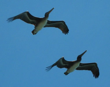
We also saw several flocks of what I believe were pelicans flying right over us.
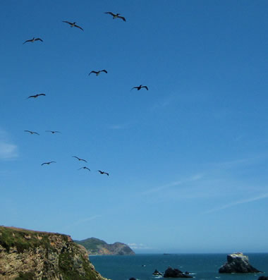
I managed to get a shot of two of them as they were flying overhead. What do you think Terrie? Terrie sez they’re “California Brown Pelicans…which we almost lost in the 1970’s due to DDT“. Thanks!
Ok, so maybe three hours was a little ambitious. With two short breaks, I think we made our way back in a little over four hours. or was it five? I dunno. There definitely was some soreness in the feet going on. But there also was a lot of looking forward to that beer we were going to have once we made it out. After going over a more detailed trail map, I calculated that we hiked about 10.8 miles.
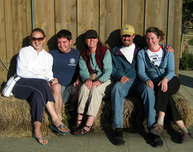
For food we found a cute taqueria-cum-tex-mex restaurant in Point Reyes Station called Rosie’s Cowboy Grill. I had a chicken taco and a bowl of real texas style chili. Half the table got fancy chili rellenos. Everyone seemed very happy. Afterwards we all departed on our respective ways, but not before I gathered the group for a photo.
Here’s a bonus shot I took of Black Mountain on the drive home. It’s always been instantly recognizable to me after someone (probably Terrie) described it as looking like the knuckles of a fist sticking out of the ground. Nice image.
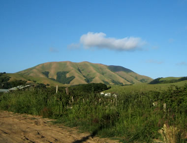
A lot of people know that the grass in California is green during the winter rain, and golden yellow the rest of the year. And at some point that change has to happen. Well right now it’s in that transition to yellow.
Blah blah blah Point Reyes. Put up the picture of you in the blanket!
Ask and ye shall receive: the aforementioned “blanket photo”.