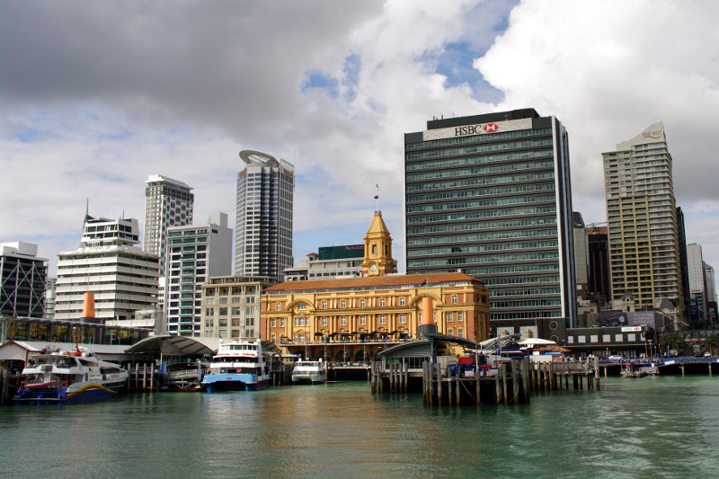
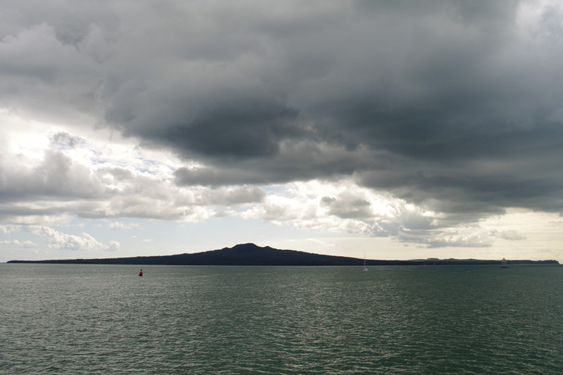
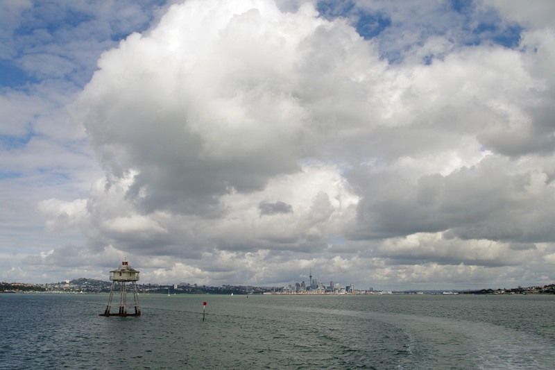
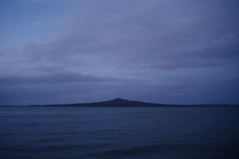
Last Thursday, feeling sufficiently settled in Auckland, we ventured out and took the ferry to Rangitoto Island. It takes less than 30 minutes to get there—the island is a visible presence from most parts of the city. It’s also one of the youngest volcanoes in the area, having sprouted only 600 years ago.
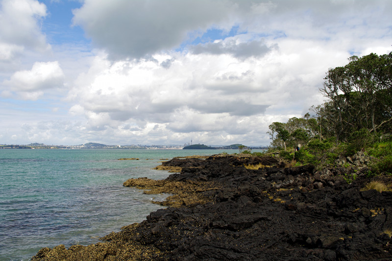
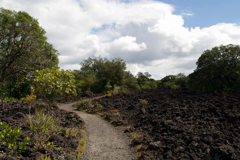
From a distance Rangitoto looks lava-black. I was expecting something like Death Valley or Mars, given how new the island is. I was wrong—it’s surprisingly lush. From the moment we stepped off the ferry, the tree cover (predominantly ferns and mangroves) was impressive. Plants have taken hold in a major way, especially in the last few hundred years, as some drawings of the crater from 1800s show it completely bare of vegetation.
An aside for my readers from the US: Kiwis (the people, not the birds) use the word “track” for “trail” and the verb “to tramp” for “to hike”. For accuracy of nomenclature, I’ll use the New Zealand variants where appropriate.
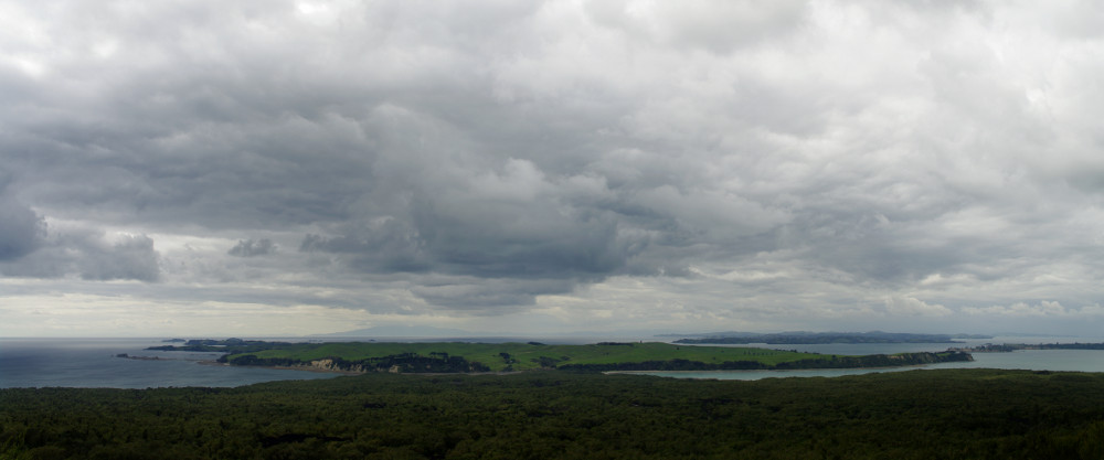
We immediately headed up the summit track, a nice path cut through the forest and fields of lava. It took a little over an hour to get to the top, just beyond the 60 meter deep and 200 meter wide crater. After devouring our ham sandwiches, we walked around the rim, and then down the boardwalk to Summit Road, where we got great views of the neighboring Motutapu Island.
The last ferry from the island left at 3:30pm (we arrived at 11am) so we took Islington Bay Road back to the wharf rather than go all the way to the eastern edge of the island and around the coastal track. We had some time to spare when we got back, so we explored the maze-like paths through Kidney Fern Glen and Kowhai Glen, before sitting down to enjoy the apples we’d brought with us.
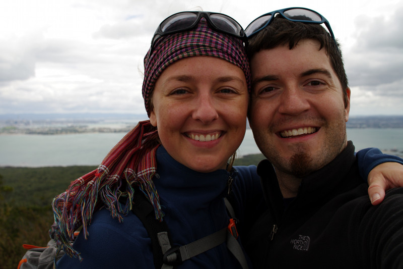
Auckland Ferry Building as we departApproaching Rangitoto (under ominous clouds) Looking back towards Auckland past Bean Rock LighthouseRangitoto’s lava rock coastlineThe summit trackStephanie and Justin at the summit
We had planned to go hiking on Sunday in Big Bend. After procuring supplies for lunch, we started on the Window Trail, which treated us to lovely views of the “window” out the mountains encircling the Chisos Mountain Basin. Then we started up the Pinnacles Trail, towards the Emory Peak trail, which leads to the highest point in the park. It didn’t seem like we collectively had the energy to make it to the top, so we decided to just climb up until it was time to break for lunch, and then head back down. Conveniently that point coincided with the discovery of a bench that had a view overlooking the basin.
View out the “window” on the Pinnacles Trail
On the way down, we took the Basin Loop Trail which was more varied in terrain and covered more ground than on the way up.
Dad, Stephanie, and Justin at the trailhead
We made it back to the campsite around 3, and though we had reserved it for one more night, we decided that if we started back towards Austin then, we could all enjoy a shower and bed before midnight (without having to play will it rain? roulette again). So we took down the tents, repacked the car, and hit the road. It was a long drive back, but we managed to pass the time chatting almost the whole way.
On Saturday we woke up at 6, and headed in the darkness towards Terlingua, TX (west of Big Bend). The sun started to rise as we left the park, and was fully up when we arrived at Far Flung Outdoor Center around 7:30. We changed into our river gear, applied copious amounts of sunscreen, and met our guide for the day, Craig (who was originally from Austin).
There were supposed to be two other people on our raft but they never showed. So we had the boat and Craig all to ourselves. We put in at Lajitas, where I caught my first sight of Mexico! Right there across the Rio Grande. While we were chatting about the nuances of an international border literally a stone’s throw away, I referred to the Mexico-side and the US-side. Then someone “corrected” me: “We like to call it ‘The Texas-side'”. Ah, Texas.
Rio Grande “put-in” at Lajitas
And so began our day-long float down the Rio Grande. Unlike our previous rafting adventures (Lower Kern, South Fork of the American River), Craig did all the paddling. We just sat and enjoyed the ride while he described the geology, biology, and history of the river.
Twice we got out of the raft and just floated down the Rio Grande (to cool down). Turns out the river is only about 3-4 feet deep with a few inches of mud/gravel at the bottom (the flow was about 1100cfs). The water was rich with sedimentation, like coffee with too much cream. At one point I waded over to Mexico and touched it.
Justin in the Rio GrandeDad in the Rio GrandeStephanie in the Rio Grande
The highlight of the trip was traversing the Santa Elena canyon, a narrow section of the river with 1800 foot walls on each side. There were several light rapids, and then one very challenging section called the Rock Slide. Craig had to navigate the raft through multiple tight spots not much wider than the raft itself. It wasn’t so much splashy-splashy, as it was very technical, and from our vantage point, it looked like there was no way the raft was getting through. He got through like he wasn’t even trying. We cheered.
Approaching the start of Santa Elena CanyonNice view within the canyonOur lunch spot“Downhill” optical illusionApproaching the end of Santa Elena Canyon
From then on it was a fairly calm ride the rest of the way. The canyon ends about as abruptly as it began. The whole route was a little over 20 miles. We got picked up around 3:30pm, and then had a nice hour-long drive through another section of the park heading back to Terlingua.
Terrain map of Santa Elena Canyon
That night, back at the campsite, we saw more ominous clouds in the sky, but we had time to cook some hot dogs and mac and cheese. Gourmet! After dinner we drove up to the lodge for a better vantage to watch how the weather developed. If it started raining, we’d get another cabin, if not, we’d head back. We were treated to another thunder and lightning show as the sun set, but all of it was in the distance. Once we’d decided the weather had passed with clear skies were above us, we headed back to our tents for the night.
We didn’t exactly get up early on Friday morning. Especially considering the time zone change. In fact we barely got the car back to the rental place before 10am. Then we started on the long drive towards Big Bend, about 5 hours from El Paso. Unlike the rest of Texas, El Paso is in the mountain time zone, so we experienced another time zone change, making it yet another hour later. We drove through some spectacular downpours on US-90 outside of Marfa, TX but when we headed into the park, it seemed that the worst was behind us. We were wrong.
Storm clouds in the side-view mirror on US-90Downpour ahead on US-90
We arrived around 5 o’clock. It was very hot and sunny, but with a lot of dramatic clouds in the sky. We continued up into the Chisos Mountain Basin, where the campground was located, and discovered it to be about 20 degrees cooler that the surrounding desert. In other words, low-80s. Perfect! Except those dramatic clouds in the distance started looking darker and more ominous. We rushed to get our tents set up in order to weather the storm, if it came. At first we had an inconsequential summer shower that came and went. Maybe that was all? Nope.
Suddenly it began to downpour. We dove into Dad’s larger tent and watched it rain and rain and rain. The rain was coming down so heavily we couldn’t even see the surrounding mountains. Everything was just grayed out. And then we noticed water in the tent. It was coming up from the bottom. It was dripping down from the top (even with the rainfly on). The rain was not letting up, and it seemed Dad’s borrowed tent was not waterproof.
So we decided to throw in the towel. We ran to the car, leaving the tents behind, and headed up to the lodge, hoping there’d be a room available. There was, as well as a restaurant (with no power!) so we sat down, ate ham sandwiches off their “power outage menu”, and watched the rain and lightning show through the floor-to-ceiling windows. By the time we were done with dinner, the rain had let up, so we went back to the campsite to tidy a few things up and check on our tents. Ours was completely dry, but Dad’s was not, so we emptied it out, and headed up to our cabin for the night. It was particularly nice knowing we’d get good night’s sleep, as the next morning we were waking up at 6 to go rafting down the Rio Grande.
I woke up early on Thursday (by accident). Stephanie was still feeling ill, poor girl, so she slept while I drove to the western half of Saguaro National Park (the Tucson Mountain District). I got there a little after 8, paid my entrance fee, and headed into the park. Along the way I stopped at the Desert Discovery Trail, a nice short paved walking loop through the desert with informational signs and sweeping views.
Saguaro – Guardian of the Desert signDesert Discovery TrailGiant saguaro cactus
Then I continued on my way to the Bajada loop, an unpaved, one-way, 6 mile road through the desert. Along the way I noticed something moving across the road just as I was about to pass over it. A snake! I stopped, reversed (worried I’d hit it), and there it was, a light-orange snake, still alive, almost all the way across the road. I rolled down the passenger side window, turned off the car, and heard the unmistakable sound of rattle as it slithered along the side of the road and into the brush. I had come face to face with a Western Diamondback Rattlesnake. And from the sound of its continuous rattle, it was none too happy with me.
Bajada loop drive
I stopped at the Valley View Trail, a short 0.4 mile trail that carves its way through the desert with a dramatic view at the end. Well worth it. Even though it was relatively short (there and back), in the direct early morning sun it felt much longer and harder than it was. Of course I was a little freaked out about stepping on a rattlesnake along the way, but I didn’t encounter any others.
Valley View Overlook TrailheadValley View Overlook trail
Panorama of the Valley View Overlook
There were several other trails that followed the various washes through the loop, but I was running low on water and hadn’t really planned on spending all day in the park. I just wanted a taste. I stopped one more time for a short hike up Signal Hill, to see some Hohokam petroglyphs, and then completed the Bajada loop and headed back to the hotel.
The Signal Hill trailSignal Hill petroglyphs
The only other thing we had planned for the day was the 5 hour drive to El Paso to meet my Dad for dinner. I figured we had plenty of time, as he had a much longer drive from Austin, so I took my time taking a shower and getting things together, when I noticed I had a voicemail. He was already in El Paso! That’s so Dad. Luckily he’s good at entertaining himself, so we hit the road, and met up with him around 6:30. We immediately went to dinner, found a nice place called The Pot Au Feu right around the corner from the hotel (thanks again, Yelp!), and enjoyed a lovely meal together.
That night we backed up his car to ours and tried to figure out how to fit all of our stuff into his car (with all of his camping stuff) and still have room for the three of us. The next morning we dropped off our rental car and started on our way to Big Bend.