How We Got to the End
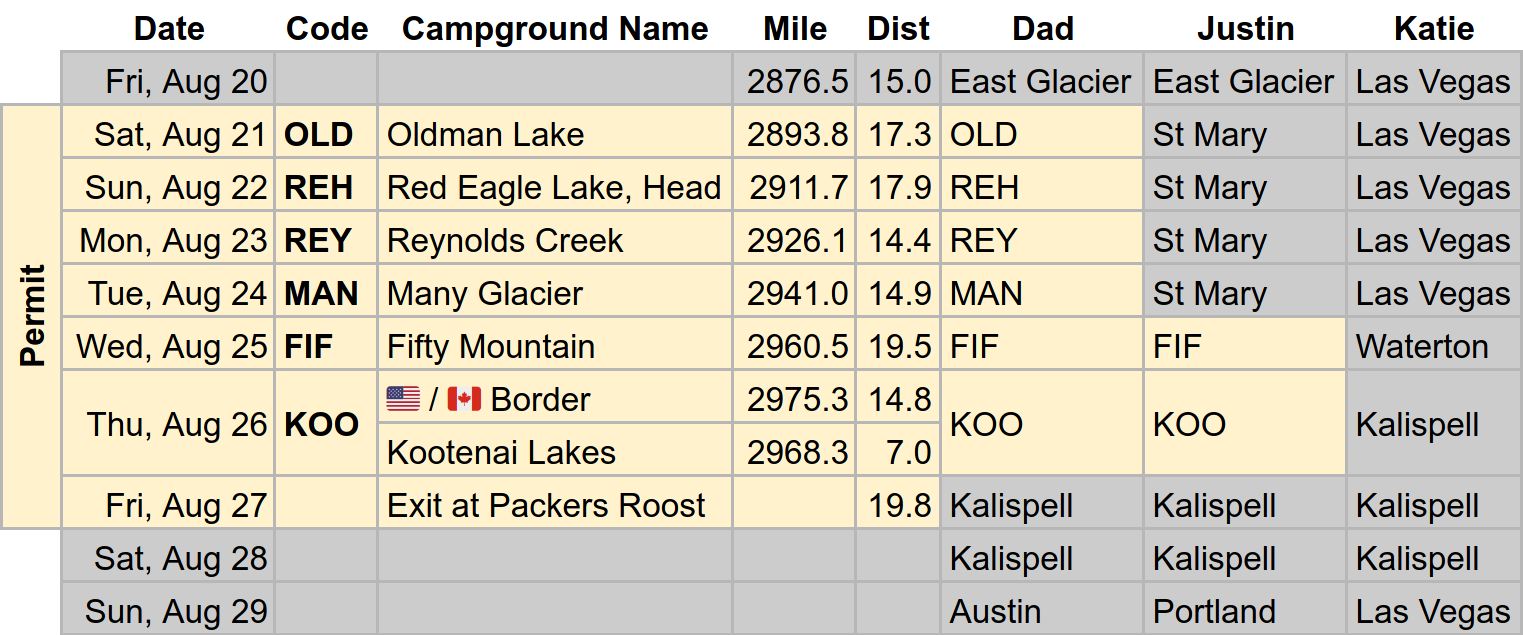
My alarm rang at 3:45 in the morning. I wanted to get in line early to secure a backcountry permit for Dad so he could complete the final 95 miles of the Continental Divide Trail within Glacier National Park. Though my sister had planned to backpack with him to the end, when the border with Canada reopened in early August, Katie opted instead for a mercifully shorter dayhike in Canada’s adjacent Waterton Lakes National Park. Hikers still couldn’t cross the border, but there seemed to be no prohibition against peaceful assembly along the 49th parallel. I was second in line 3 hours before the ranger station opened at 8. Even though I had checked and rechecked the backcountry sites I was going to request, I was still anxious that I might have overlooked some constraint or created a “strange loop” when I accelerated the itinerary after Katie’s plans changed. My nervousness was unfounded. I gave my permit request to the ranger, paid the fee, and walked away moments later, golden ticket in hand.
Dad’s third day in Glacier was supposed to be a cakewalk. It was only 14.4 miles with almost no elevation change, but when I hiked in with his resupply, I found him thoroughly depleted—and wondering if there was any way we could decelerate the longer days ahead. And then, out of the blue, it started to rain. He pitched his tent while hurling a fusillade of curses, sucked down the chili mac I rehydrated for lunch, and then crawled into his cave to hibernate. That night, while chomping on one of his cherished cherry Tootsie Pops, he dislodged a silver crown. “You are literally falling apart,” I deadpanned when he showed me later.
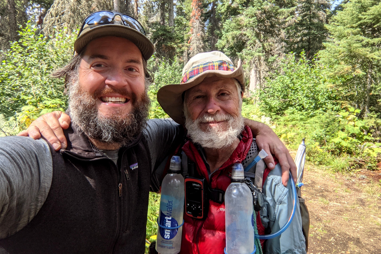
We met up in Many Glacier, 34 miles from the northern terminus of the CDT, for his 44th and final resupply. Since Dad couldn’t cross the border into Canada, conventional wisdom held that he’d have 34 bonus miles to “savor” all the way back to Many Glacier. It was only because I’d scoured the map looking for some way to reduce the mileage for my sister that I discovered the Packers Roost trailhead, just south of “The Loop” on Going-to-the-Sun Road. The Fifty Mountain backcountry campground (where I’d be joining Dad until the end) is only 12 miles from Packers Roost—whereas it’s 19.5 miles from Many Glacier on the CDT. For Dad, this meant that ending at Packers Roost would reduce those bonus miles on the way out by 7.5, and for me, starting and ending at Packers Roost would save 15! Except that Dad’s trepidation about the next day’s miles and elevation had not waned. Though his spirits had greatly improved, he pleaded with me, “Is there any way we could meet up tomorrow, sooner?”
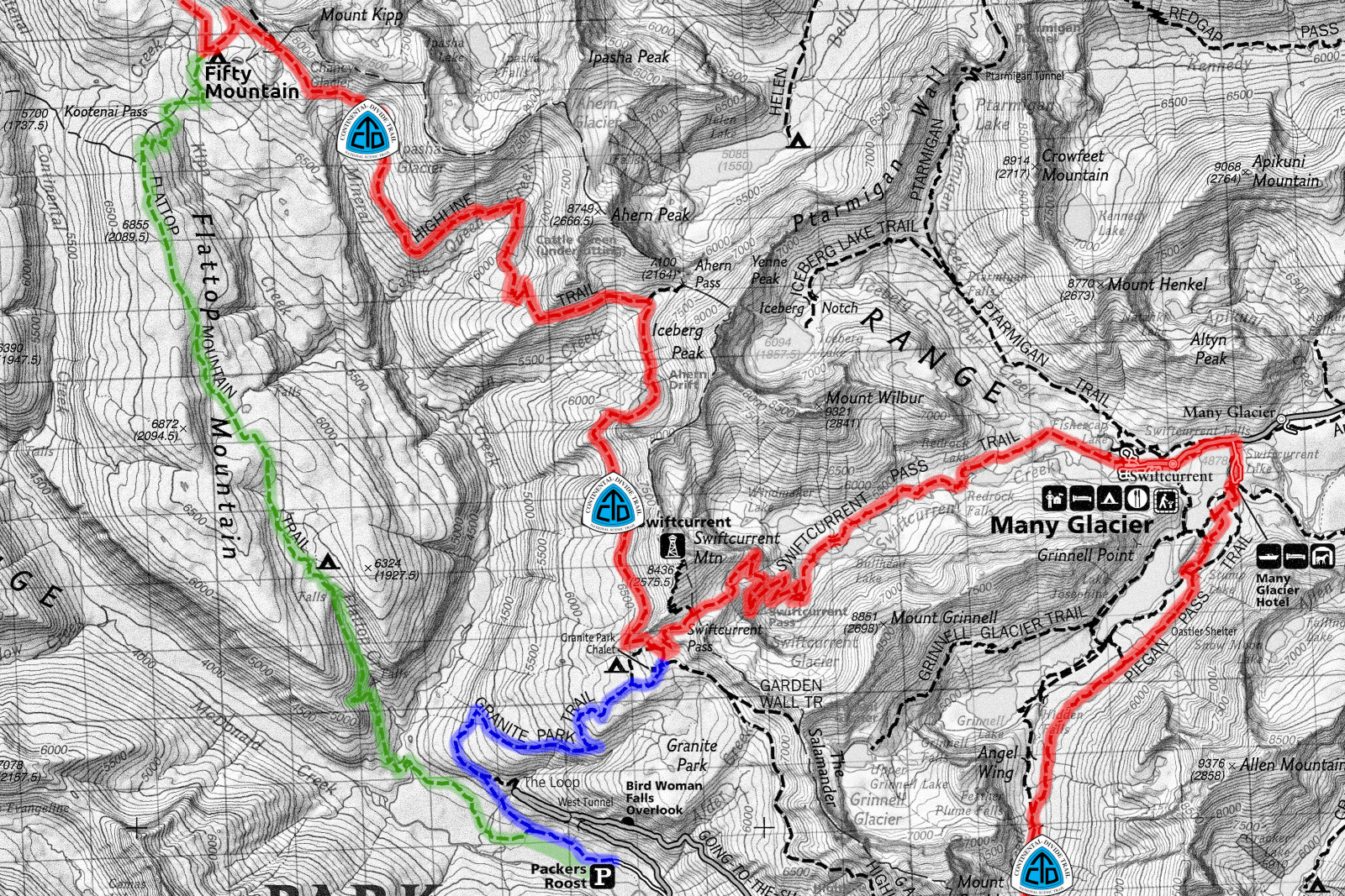
The next morning, I emerged from the trail into a throng of people milling about the Granite Park Chalet. I called out, “Hey Dad!” in the direction of a familiar red puffy vest. When I reached him he was grinning. “I beat you,” he crowed, “by like 7 minutes.” It was good to see him in a better mood. Instead of taking the Flattop Mountain Trail, I had climbed 3,000 feet over 5 miles on the Granite Park Trail to meet up with him here, sooner. From the chalet we hiked 12 miles together on the CDT to Fifty Mountain. On the way there we crossed paths with several groups of novice backpackers, all of whom were beyond impressed with Dad’s feat, be it how many miles he was hiking that day, “19 miles!? No way!”, or how many he’d hiked since starting the PCT in 2014, “7,800 miles!? No way!” In one instance, Dad apparently cut such a hike-hardened figure that a strapping, 6-foot tall, 20-something-year-old handed over his backcountry permit. He had pegged Dad for a ranger!
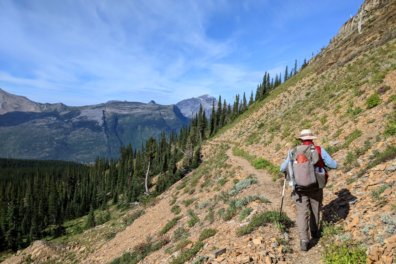
On Thursday, August 26th, we set off for the Canadian border—only 15 miles away. The trail began with an easy climb, followed by a steep, 2,400-foot descent along a mountainside thick with thimbleberries. The rest of the way would be mostly flat. Once at the border, we’d need to turn around and retrace our steps for 7 miles to reach our campsite at Kootenai Lakes that night. Which meant that morning we’d pass by it only 8 miles in. Dad had the brilliant idea to stop, setup our tents, and hang our bear bags, jettisoning everything but water and lunch so we could slackpack for what amounted to 14 of the day’s 22 miles! Meanwhile, Katie, who had flown to Montana and successfully driven into Canada the night before, was beginning her hike to the border.
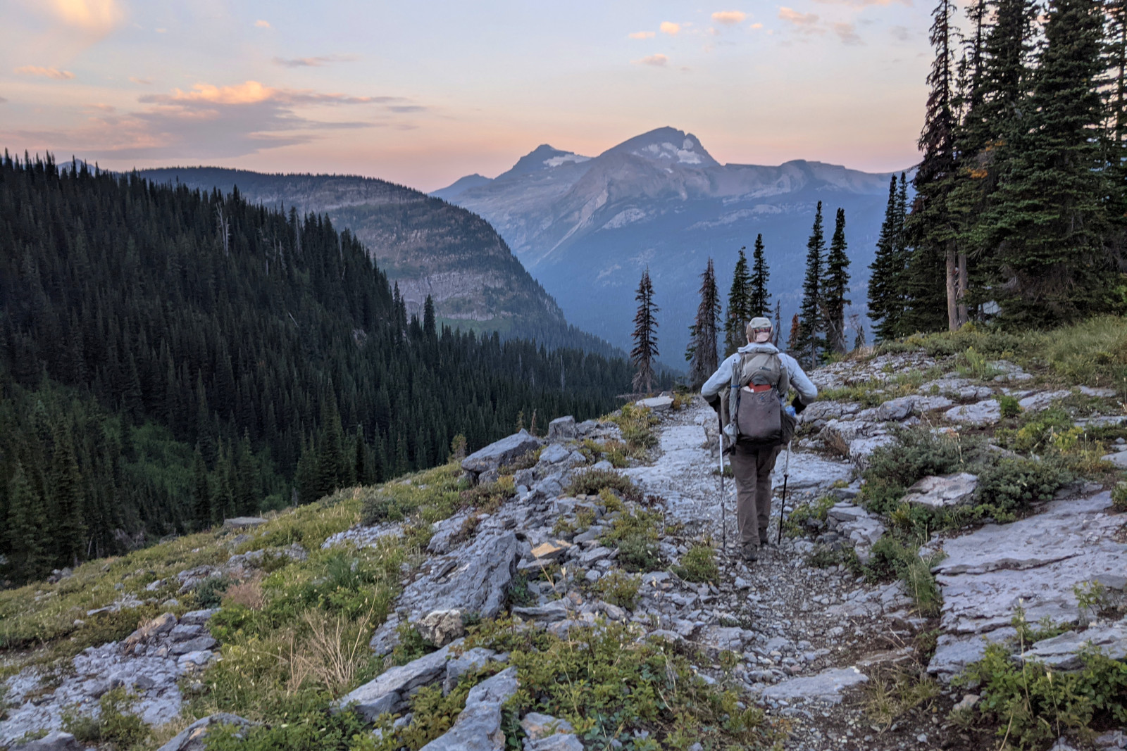
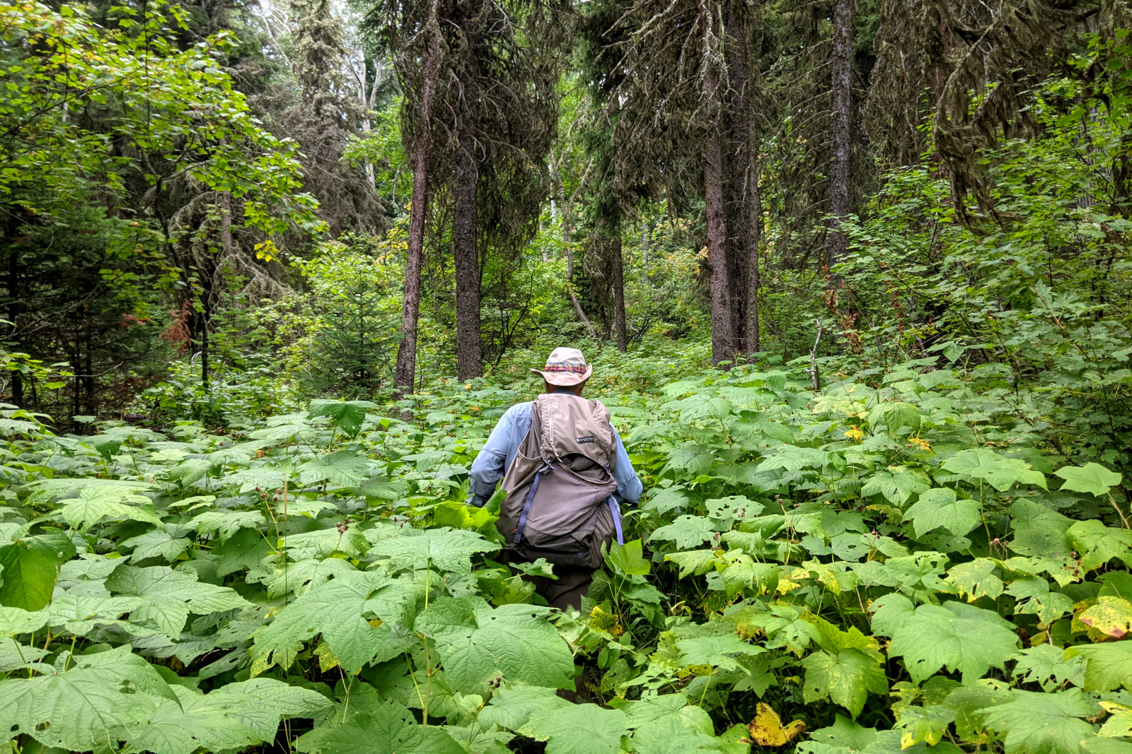
With our packs reduced to the size of life preservers and our resolve not to stop for lunch until the end, Dad started pushing hard, doing just over 3 miles-per-hour. I sent Katie an inReach message that we’d likely reach the border around 1. The dense, green, overgrown trail continued unabated. There was no opening, no change to indicate that we were approaching any remarkable boundary, natural or political, until we were less 100 feet from Katie. We had no idea in this retrograde age of “walls” if we’d even be able to hug. But it seemed like the border here was less of a harsh plane and more a fuzzy buffer—technically a 20-foot wide “vista”—where fraternization was tolerated without setting off any alarms.
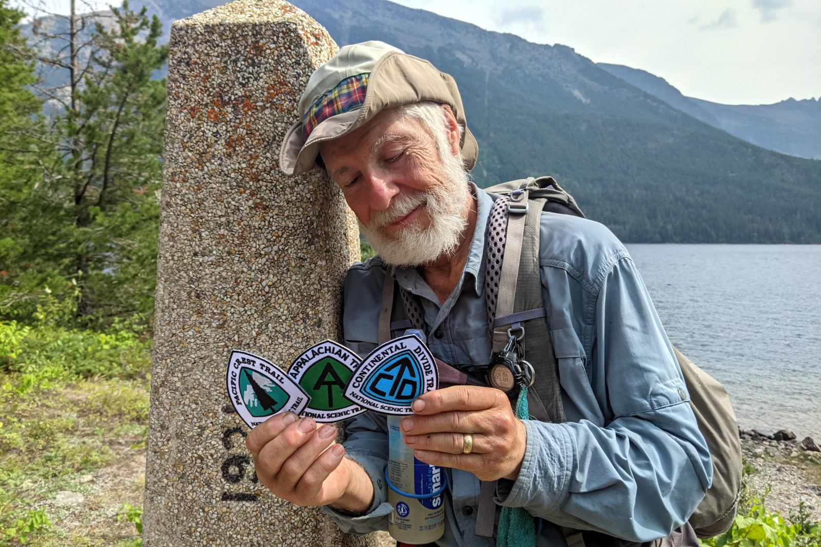
We took photos, and my favorite is one of Dad, unplanned and unposed, where for the briefest of moments, leaning against the boundary marker, he looked down at the 3 trail blaze patches Katie had just given him, one for each trail he’s now completed, as if reflecting on this rare accomplishment. And then we all plopped down on the rocky beach along Upper Waterton Lake to eat lunch. After 73 days, Dad had hiked 1,185.4 miles, completing the Continental Divide Trail and thus the Triple Crown of Hiking.
There are ends, and then there are ends. We knew that reaching the border was an intermediate end, an arbitrary human construct compounded by another—such that we could not follow Katie a mere 4 miles into Canada so that she could drive us to a hotel in Montana. She had to hike, alone, back to her rental car and recross into the United States by road while Dad and I hiked 7 miles back to our already pitched tents. And then first thing the next morning, we had to surmount the steep overgrown mountainside we’d come down the day before, except this time, each giant thimbleberry leaf, wet from the morning’s light rain, made the 2,400-foot climb feel like a miles-long waist-deep stream crossing. Eventually we got to the point where we could say, “It’s all downhill from here,” and mean it more than just figuratively, as we had to descend 3,170 feet over the remaining 9 miles. The true end came when we finally reached the Jeep at Packers Roost, and we didn’t have to hike anymore.
A hearty congratulations to Tartan and his team!
What an amazing journey. I really enjoyed following along and your dad is going to be grateful to have this record in the coming years.
Congratulations from the Kiwi connection. We think you both need a cup of tea & a lie down!!
I passed this along to Kathie and Susan, too. Just wonderful. Loved reading through it all!
Congratulations to one amazing person! Your perseverance and tenacity, tackling all 3 trails AFTER retirement is a monumental accomplishment! May you enjoy many years of story telling now. I was so fortunate to have met you!
So amazing. Glad I started checking in a couple weeks ago to see what was new!
Congratulations to all three of you! Amazing accomplishment!
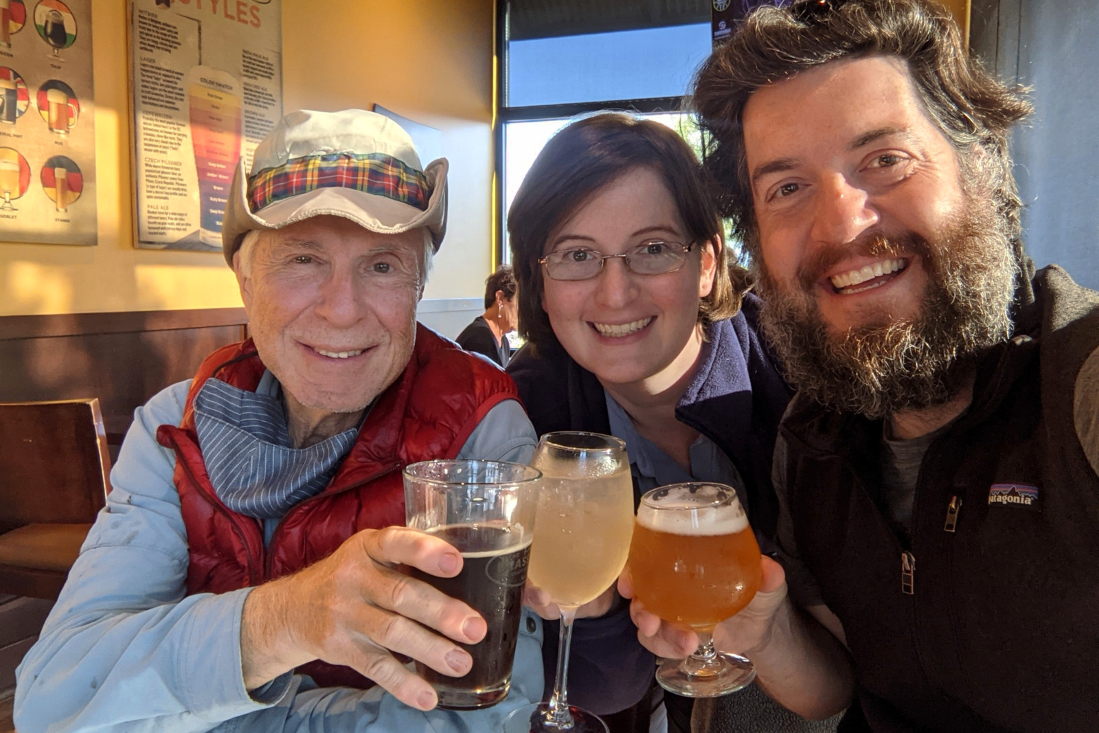
Congratulatons ! Let me say…your beer glasses are definitely toooo small for ending this callenge ! Thank you for your last E-Mail Justin. Now i am late for an answer – but X-mas card sending is around the corner ;-). Love your fathers picture with the 3 stickers – and i have to say – i like his beard very.