Bisecting “The Bob”
One row, highlighted red, near the bottom of the spreadsheet we use to manage the hike, has been giving us “the evil eye” since the beginning. This row has been threatening Dad with a 118-mile stretch of the CDT in the Bob Marshall Wilderness, between the popular Benchmark Trailhead in the south and US Route 2 in the north—without any intermediate access roads. It so dwarfed every other section that had come before (and will come after) that I was certain there must be a dirt track that crossed the trail somewhere in there. Spoiler alert: there is not.
As directed by the Wilderness Act of 1964, “The Bob”, as it is informally known, is to remain roadless.
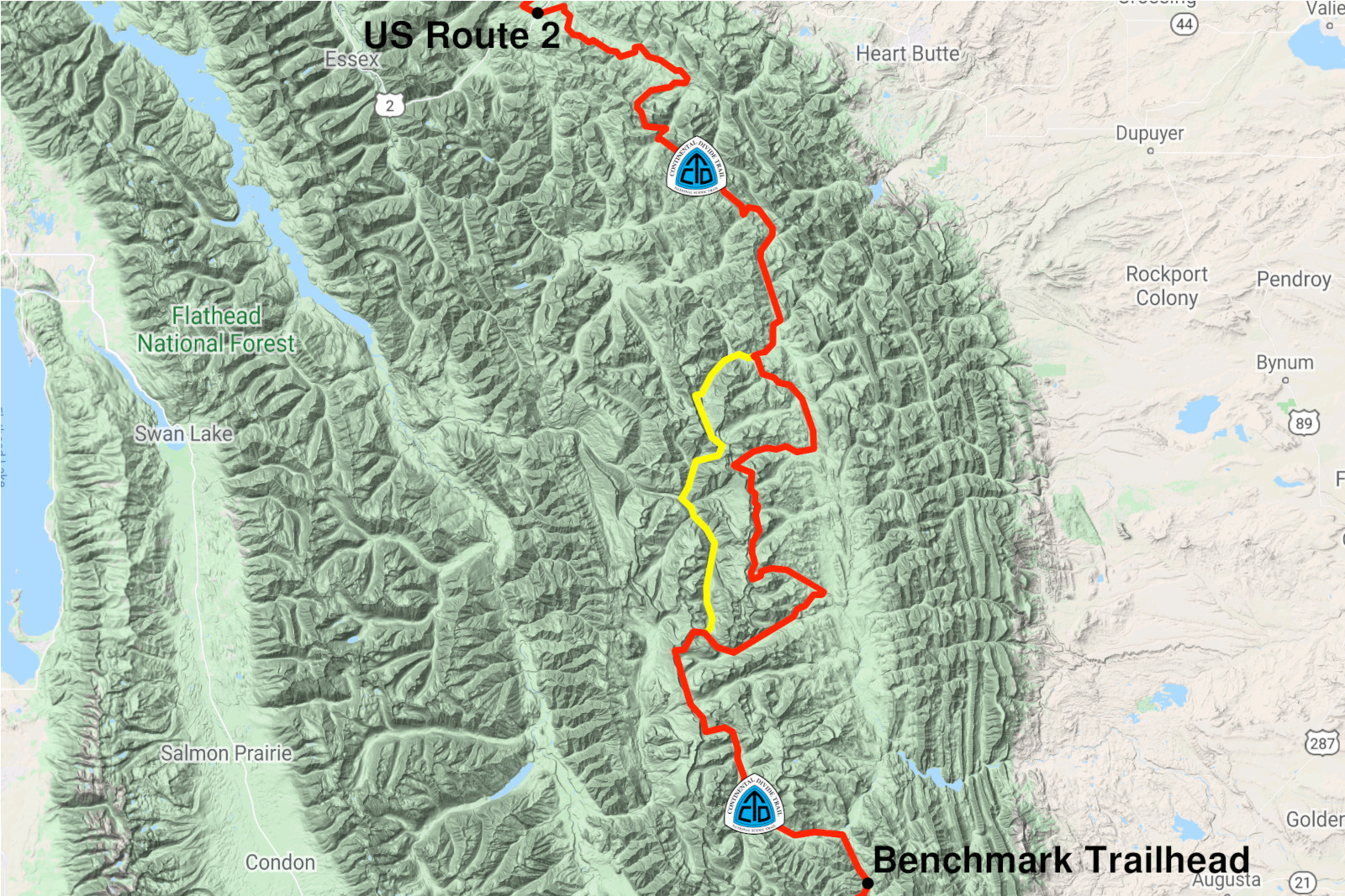
Given this, would Dad have the stamina to hike 20 miles for 6 days in a row, carrying 4 days of food, stitches still holding his ankle together, while I hiked toward him from the end over 2 days with his resupply? Maybe he’d at least consider the popular “Spotted Bear” alternate (in yellow above) to save almost 15 miles? Normally a slave to the red line in Guthook (which marks the “standard” route of what many consider a choose-your-own-adventure trail), he relented: “I think I have to take the alternate—it’s the only way I’ll be able to make it through.” There was, however, another potential solution to the 118-mile resupply problem: bisect “The Bob”.
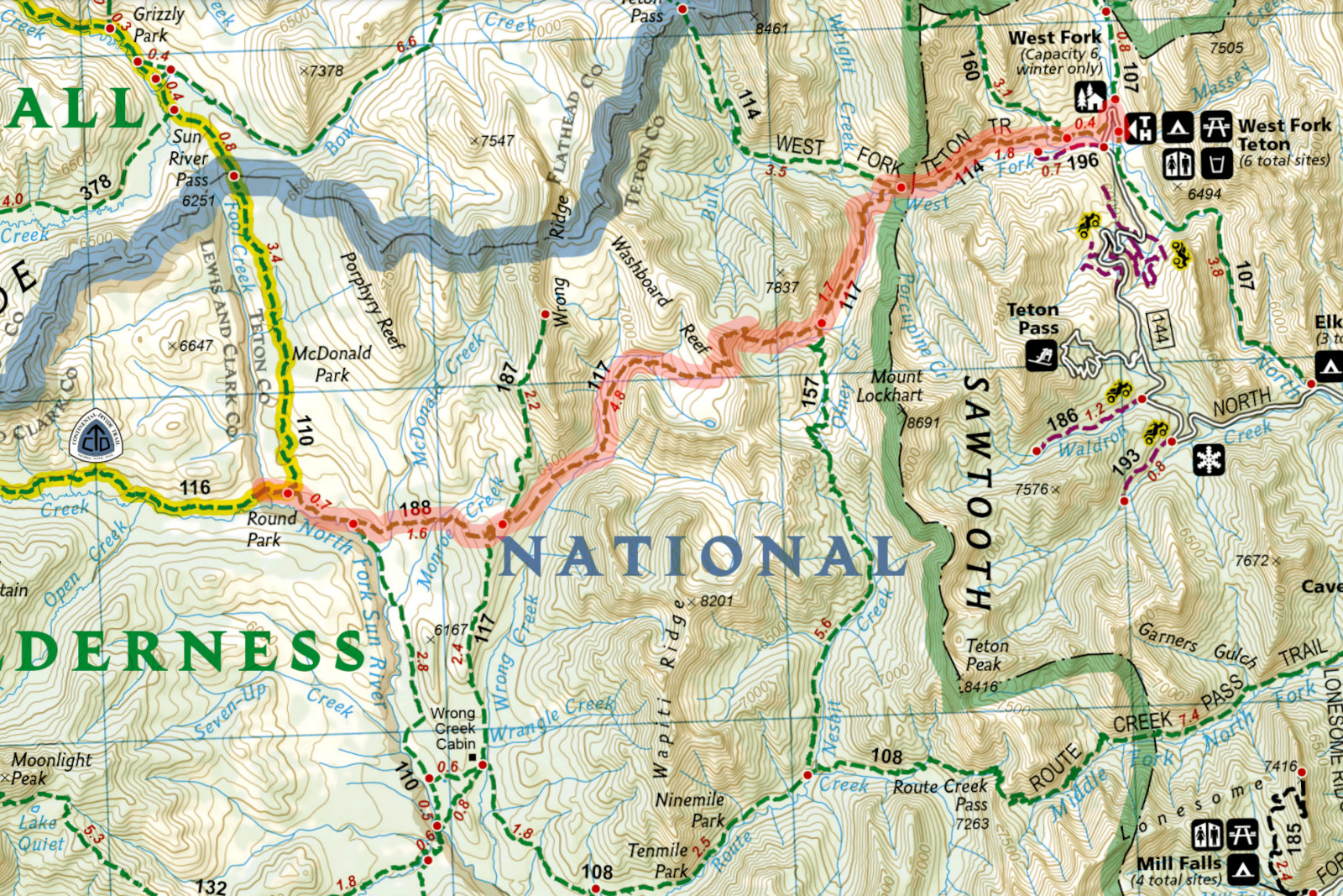
Right around its midpoint in the Bob Marshall Wilderness, the CDT lurches to the east near a handful of trailheads. I picked one that seemed promising, added up the individual trail segments to the CDT, and got…18.3 miles. That’s only a single day’s hike! And to think, I had almost committed myself to 30–40 miles over 2 days and back again. I would have stopped there, but I spotted another trailhead from which the route seemed less circuitous. So again, I added up the segments—and I got it down to a mere 11.2 miles! Had I somehow folded the space-time continuum? On this route I could make it to the CDT and back within a single day—though of course for the sake of company I’d camp with Dad for the night. Assuming he agreed with this plan, and he did, we’d be meeting up at a waypoint in Guthook named “Fool Creek” which promised a tentsite, water, and an omen—that I did not heed—for anyone foolish enough to make this journey.
I sent Dad a cheery update when I was 4 miles in that would soon become a gross understatement of what I faced: “Lotsa deadfall, so it’s been slow goin’.” What had seemed initially like “slow goin’” was actually a perfectly respectable 2-mile-per-hour pace on a trail I could easily follow with only sporadic clumps of blowdowns, all the while bearing the burden of a pack laden with 6 days of food: 2 for me and 4 for Dad. Moments later I was clambering up an overgrown hillside and struggling to follow the dashed green line on my map that only got wider as I zoomed in, as if indicating a grand boulevard some 200 feet across. At first I’d scan everything within my field of view and see nothing but a thicket of willows, shoulder-height pines, a herringbone matrix of deadfall, and the silvery snags that would soon join them. Then I’d look again, and the trail would materialize through sheer force of will. I’d conjure an arc of small shrubs, growing along the perimeter of the erstwhile trail, after fire scoured this valley years earlier. I’d imagine that a scar in one of the snags was the shadow of a trail blaze, a lowercase-i once carved into the bark before it had been denuded by flame. I’d sense the subtle leveling of an eroded switchback, cut into the steep, concave slope of a mountainside gully. I’d connect disparate hoof prints in ground once tamped down by boots, now friable after many seasons of freeze and thaw, abandoned by all but the native cervids. This telekinesis came at no small cost, as I slowed down to an abysmal 1.3 miles-per-hour (or 46 minutes-per-mile) over the next 6.4 miles—not counting the 40 minutes I stopped along Wrong Creek (perhaps the map is trying to tell me something?) to eat lunch, filter water, and recompose myself for the hard-fought but inevitable denouement when I met up with Dad at Fool Creek.

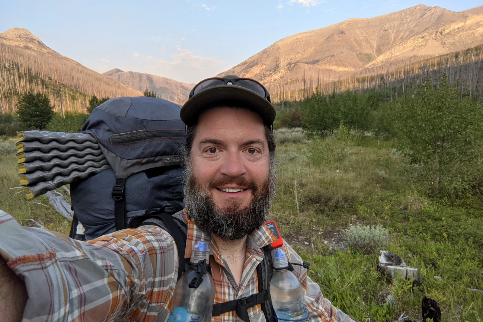
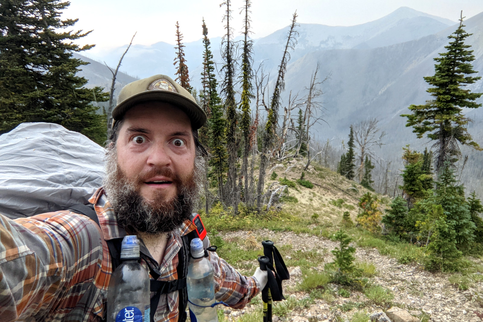
Though I relish a challenge, the idea of repeating my performance in reverse the next day with the added threat of rain (more its concomitant lightning) filled me with the kind of anxious dread I usually reserve for job interviews: I will do anything to avoid this, I will never leave Fool Creek, I will remain here for the rest of my days. But I set my alarm for 4:45. There are some hard things we have to do. We broke camp before dawn the next morning, hiking with our headlamps on, hoping to beat the rain. It was so dark, Dad overshot his turn-off, and then I did the same, as my “trail” had no discernible turn-off. One mile from camp, I simply walked off-trail into the woods. The sky was clear for now, but I had to cover a 6-mile hellscape with over 2,000 feet of elevation gain before reaching the bald peak of Washboard Reef, the last place on Earth I wanted to be when the storm hit. So I trudged through the tangle as fast I could, chased by dark clouds and taunted by sporadic showers. Just before I reached the treeline of this snag forest, a thunderclap exploded with symphonic gravitas just south of me. I would be climbing north for a quarter-mile along an exposed ridge, above which, at that very moment, the gathering clouds broke to reveal the faintest impression of blue sky. I put my head down, clenched my jaw, and walked the ridge. Nearing the top, I skirted the peak, sliding with every step across a steep face of scree in a feeble effort to make my head less appealing to any excited electrons in the vicinity. Once on the other side, I dropped back into the relative safety of tall trees. Trail or no trail, it was all downhill from there. Dad emerged from “The Bob” 3 days later. After 66 days he’d hiked 1,071.6 miles.
Thank goodness you are getting to the finish! Keep going, you are all awesome.
Being a peakbagger first and a long distance trail hiker second, I would have relished getting to the summit of Washboard Reef. Any summit cairn ?
I don’t recall any cairn, but given the high winds on the first day and thunderstorm on the second, I wouldn’t put much faith in my recollection.