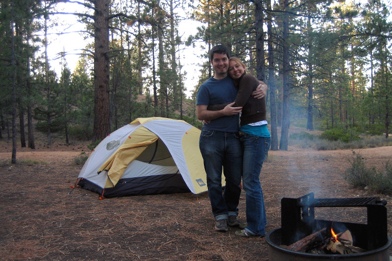
My favorite thing about camping is making a fire and cooking and eating outdoors. Before setting up camp at Bryce, we drove over to the Camper’s General Store and picked up some hot dogs, buns, and their last bag of marshmallows—all Stephanie’s idea, after seeing that our campsite had a firepit with grill. We already had two bundles of wood, which we’d been hauling around with us since we weren’t able to camp at Arches.
It gets pretty cold at night in Bryce, the elevation is like 9000ft, so the fire was crucial. After we’d gotten a good pile of glowing embers, we were actually able to roast the hot dogs and toast the buns on the grill. I say actually because I’ve never grilled something over anything but charcoal or gas—aside from the occasional wood chip smoking experiments in Texas. Hot dogs with buns toasted on both sides and slices of our leftover emmentaler cheese on a cold night: that’s heaven. Afterwards we roasted marshmallows, skipping the graham crackers and chocolate altogether.
One of my least favorite things about camping is the sleeping part. We’ve got Thermarest pads and pillows, and decent mummy sleeping bags, but I always eat and drink too much right before going to bed that makes an already uncomfortable experience more so. This time there were no chips and guacamole, and I limited myself to 2 hot dogs and a beer and a half. My stomach was happier, but I still haven’t learned how to sleep in a sleeping bag. I’m a rotator. I constantly turn around during the night, and I usually have my legs spread in a position not amenable to a mummy bag. As a result, I find my camping sleeping experiences to be semi-conscious affairs. Sleeping pills might be in order. Or muscle relaxants?
Of course drinking too much (of anything, water or beer) leads to another problem, which I’m surprised I don’t hear my more camping-savvy friends talking about more often. Well, let me break the seal. Usually about part way through the night, my bladder fills up, and alerts my already uncomfortable, semi-conscious self of its state and impending needs. Of course I’m in some state of undress, wrapped in a mummy bag, inside a tent on the ground in the middle of the woods where invariably it’s cold out. Getting up to pee never seems to be an option, so I usually suffer the rest of the night holding my bladder until some point when I notice it’s light out which means: safe to wake up and pee. This time however, vowing not to be disturbed, I brought some old soft drink cups with lids into the tent, and though the urge to pee didn’t wake me this time—due to drinking in moderation and peeing right before bed—I did use the cup after I woke up, for science.
Why do we endure all this? Well, it’s really cool to wake up right at your destination for only $10 (plus some fraction of the $80 annual National Parks pass). Stephanie really loves setting up the tent and unrolling our sleeping bags. I love cooking outdoors. And I think part of the reason we’ve thrown ourselves into camping so vigorously as of late is because it provides a contrast from our recently urbanized lifestyles. As we’ve said often, we miss green.
Like any short hotel stay, it’s a bummer to arrive at night and then pack up everything and check out the next morning. So we both simultaneously decided we should stay in Bryce a second night. This meant we could wake up Wednesday morning without having to tear everything down, spend the day hiking the canyon, and then return to our already set up campsite. Incidentally this would be the first time we’d spent more than a single night camping together.
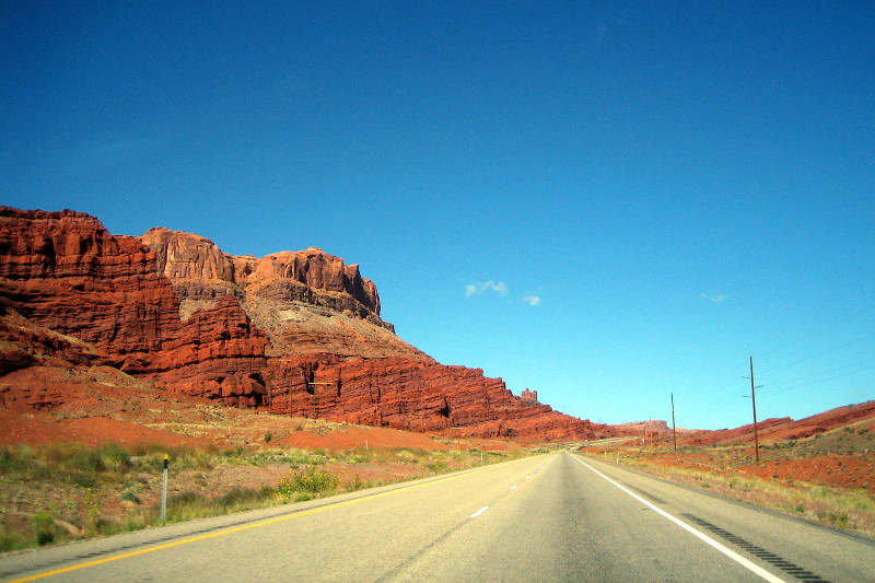
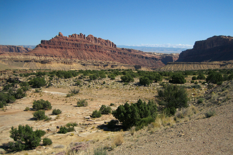
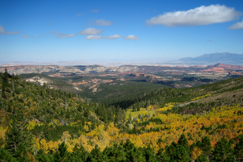
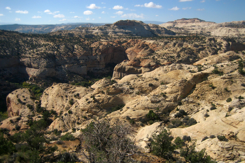
Rather than spend a full day at Canyonlands on Tuesday, we decided to make tracks for Bryce Canyon National Park. Our route took us back the way we came toward Green River, and then we continued west on I-70 because our Utah map had half a dozen or more scenic overlooks marked on that short stretch alone.
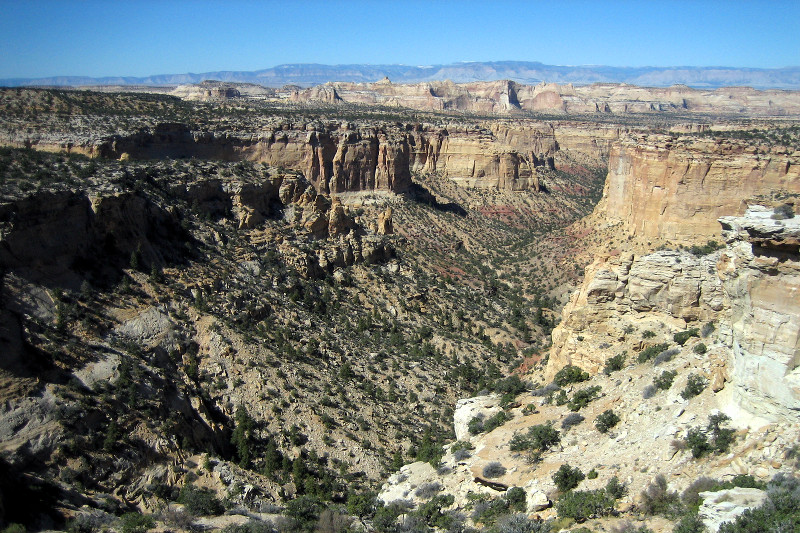
I took copious pictures as we drove along, and stopped 2 or 3 times to check out the amazing overlooks. The highway literally cut a path through several canyons.
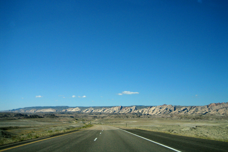
We got off the interstate at UT-72 heading towards Loa, through the Dixie National Forest. Had great burgers at pretty much the only place to get food in Loa, Maria’s Grill, and then continued on, through the immense Grand Staircase-Escalante National Monument (a Bureau of Land Management “monument”).
I appreciate the Grand Canyon’s grandness, but man there are a lot of grand canyons out there. At one point on UT-10 going through the Grand Staircase the speed limit dropped from like 60 to 30 (and we’d probably been going ~75). Suddenly we found ourselves on a road with deep canyons on both sides, and not much of a shoulder or guardrails either. That was the first time I genuinely felt shivers in my legs. Thankfully Stephanie was driving.
Five hours later we made it to Bryce, their two campgrounds had availability, hurray, so we drove over the Sunset Campground, picked a winning campsite (#275), and started setting up for the night.
The road out of MoabMountains formed out of upended layers of rock (they probably have a more scientific name)Upended mountains up closeView from a scenic overlook, I think this was called Black Canyon, or Dragon Canyon, or maybe Black Dragon Canyon!Another scenic overlook, called Ghost Canyon I thinkFall colors up in the Dixie National ForestAnother view from the road in Dixie National ForestOverlook in the Grand StaircaseIn Bryce finally, camping finally!
So it was lightly sprinkling when we left the Devils Garden trailhead on the path to the Double-O Arch. By the time we got going a bit, the rain stopped, and we had blue skies ahead (and very moody skies behind), with the sun setting setting to the left. Difficult to capture with a camera, but just fine for our eyes.
In our excitement and rush to get out on the trail, we forgot the trail map and didn’t bring a watch, though we discovered later that my cell phone actually got service out there. Initially the lack of a map didn’t seem like much of an issue—the standard National Park Service maps aren’t that detailed and the trail seemed fairly well worn. After a while though there was no trail, just rock.
We ended up taking a fork that wasn’t actually a fork and found ourselves scrambling along the rocks looking for a telltale footprint in the wet sand—or a rock cairn (a pile of rocks arranged by humans)—but we found neither and decided to head back. Until Stephanie caught a glimpse of a cairn on the crest of a rock fin way above us. Given the time and lack of map pressures, I just as soon figured we should head back, but Stephanie wanted to push on. Lesson learned: follow the rock cairns!
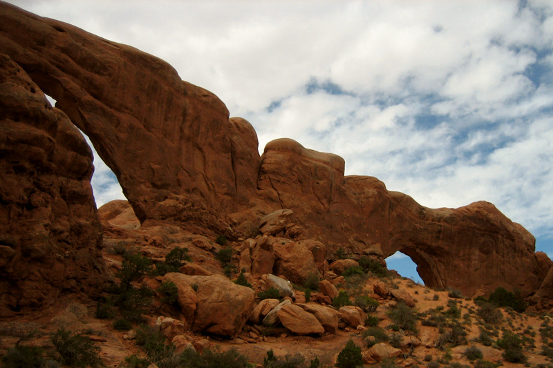
Eventually we did make it all the way out to the Double-O Arch, and decided not to continue on the more primitive trail around the loop, given the setting sun and the fact that we already got lost once. So after a snack of baguette and emmentaler cheese, we headed back the way we came, except this time the setting sun cast an orange glow on the already orange rocks and made the trek feel like new.
Devils Garden TrailheadOn the trail, looking eastLandscape ArchLooking back on the Devil’s Garden trailDouble-O arch at sunsetRock cairn archView near Double-O archSunset view from Devils Garden TrailThis rock fin was actually the trail!We made it back to the trailhead at sunset
Arches National Park opens at 7:30. Apparently they have 24 first-come, first-serve campsites. Considering we were out late last night—dinner at the Moab Brewery—getting out of the hotel before 7:30 was out of the question. We aimed (optimistically) for 9, got there after 9:40. Not too bad considering we’re on vacation. Of course the campsites were all taken (turns out only 5 actually became available that morning, and all of them got snapped up right at 7:30) which was a little disappointing. But whatever. We were prepared for another night of Motel 6 camping.
Driving towards the entrance to Arches National Park from Moab
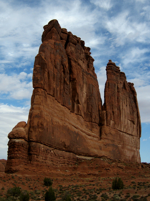
So began a long slow drive into the park, along 18 miles of road that wove through innumerable incredible rock formations. Towers, shear cliffs, walls, petrified sand dunes, and of course: arches. This is just mind-blowing stuff. Like stick the camera out the window while I’m driving (slowly) every other minute. Occasionally we’d stop to hike around one well-known formation or another. But our intended destination was a 7 mile hike at the end of the road.
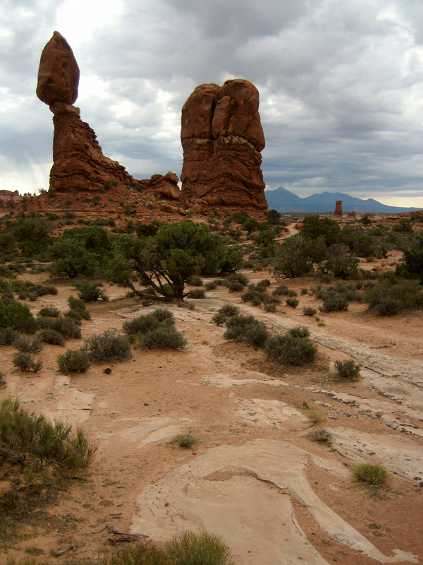
Some of our first views from just inside the parkOrgan RockThe aptly named, Balanced RockThe “Windows”
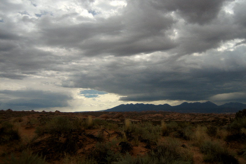
Unfortunately a rain storm over the Lasal Mountains was slowly creeping our way all morning. We knew from the weather reports this was coming. We just hoped we’d get lucky and fall on the glass half empty side of “there’s a 50% chance of thunderstorms.” Eventually the clouds were messing up the light in my photos, and by the time we got to our hiking destination, Devils Garden, it started to pour.
Distant storm approaching from the Lasal Mountains
This actually turned out to be a boon because Stephanie was still recovering from her dance intensity, and needed more sleep. So we parked, she napped, I pulled out a book (and eventually did some napping myself), and it rained. And rained and rained. And Stephanie slept and slept and slept.
A little over 2 hours later I was finishing Do Androids Dream of Electric Sheep, Stephanie started to emerge from her deep nap, and it was still raining. It looked like hiking was a no-go, another bummer. Stephanie took over driving duties with the intention of heading back to Moab, but first decided to explore the campground that we wouldn’t be staying at—it looked really cool.
And then the rain finally let up. It was just before 4, and the sun sets around 7, not leaving much time for a 3-4 hour hike. But what the heck, why not, right? So we parked at the trailhead and quickly prepared for hiking: adding layers, stocking up on water and snacks, changing socks, etc. And we were off. Finally!