After a quick lunch in Mammoth Hot Springs, we hit the road north, leaving behind both Yellowstone and Wyoming for Montana’s Big Sky Country. We took US-89 out of the park, traveled west a bit on I-90, and then headed the rest of the way north on US-287—a drive I cannot recommend enough, especially the part after it overlaps with I-15. There is nothing around, except the Rocky Mountains to the west, Canada to the north, and rolling fields of the Great Plains all around. For hours. Soul cleansing stuff.
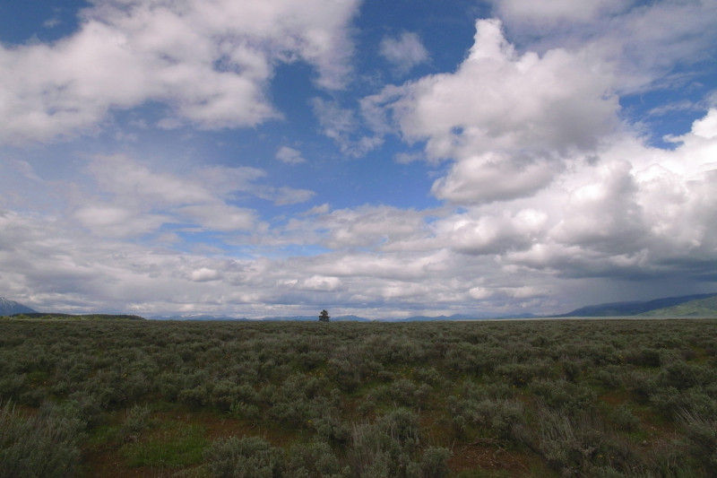
Our goal for the day was to reach Browning, Montana, the largest city near the east entrance of Glacier National Park. It’s located within the Blackfeet Indian Reservation. Upon arrival we discovered that there was not much happening in the way of hotels or restaurants, so we continued up the road to St. Mary, located right at the entrance to the park. We stopped at a nice lodge with a restaurant and got a room for Thursday and Friday night.
A woman in the gift shop informed us that the Going-To-The-Sun road through the park was not yet open, a chunk in the middle was partly destroyed due to a major avalanche during the winter, and another part was still being plowed. But she encouraged us to drive into the park up until the road was closed, about 12 miles, as the animals like to come out before dusk. We’d been driving all day, but since the sun wouldn’t be setting until after 10pm, we figured, why not. We drove into the park, didn’t see any animals, and drove back to the lodge for a late dinner.
Leaving YellowstoneUS-89 just north of YellowstoneUS-287 on the way to Glacier National ParkFirst view of Glacier National Park along the road to St. Mary
As soon as we got our bearings in Grand Teton National Park, we called to see if we could reserve a tent cabin in Colter Bay Village for Monday night. They had availability, which meant: we were staying in Grand Teton National Park!
As an aside: I should mention that the advanced-planning for this trip consisted of only three reservations: the flight from San Antonio to SLC on Sunday, June 14, the flight from Spokane, Washington to SFO on Sunday, June 21, and a car rental to span the week. Everything else was up to us to figure out as we went along.
I should probably also reiterate something that we learned during our first trip to France: it’s no fun to stay in a place for only one night at a time when we’re traveling. If we stay put for two nights, then our trip naturally breaks itself up into full days without the stress of packing and unpacking followed by half days of traveling.
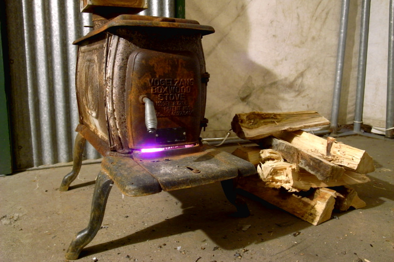
By the time we wound our way through the park and up to Colter Bay Village, we’d decided to extend our reservation for two nights, so we could go hiking on Tuesday as long as we wanted without worrying about packing up and traveling that night. Thankfully they also had availability on Tuesday night (mid-June is still early season for the northern parks) so we used the rest of Monday to unpack, treat ourselves to a fancy dinner at the Colter Bay Ranch House, and fail miserably at lighting a fire in our tent cabin’s wood stove.
Driving into Grand Teton National ParkSagebrush flats below the TetonsMassive outflow from Jackson Lake Dam into the Snake RiverThe weather was finicky, alternating between cloudy and drizzlyOur home away from home, a Colter Bay tent cabinWe figured out the wood stove on our second, much cozier, night
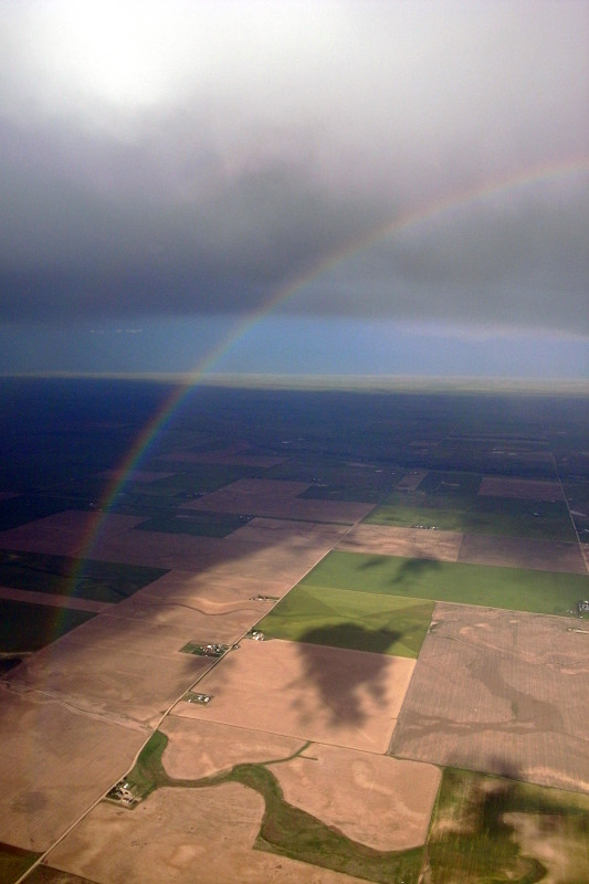
On Sunday, as everyone who’d come into town for my brother’s wedding was heading home, Stephanie and I caught a flight to Salt Lake City. Before the plane made its scheduled stop in Denver, we had to circle the airport several times to let a storm pass, and then we had to wait at the gate for similarly afflicted passengers on other flights.
Rainbow over farmland outside Denver
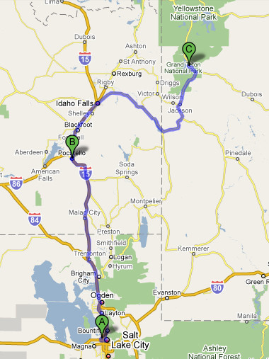
We arrived at SLC about thirty minutes late, got our bags and rental car in record time, and then immediately hit I-15 north. 166 miles later, we were in Pocatello, Idaho, arbitrarily chosen for its Motel 6 and our exhaustion. I’d never been to Idaho before, but since we were only traveling through, I’m not sure that counts.
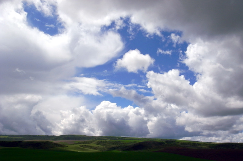
Idaho sod farms and clouds
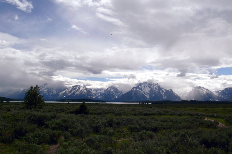
The next morning we woke up and headed north to Idaho Falls, where we got off the interstate and took US 26 over to Jackson, Wyoming and into Grand Teton National Park. We got our first glimpse of the Tetons, partly obscured by clouds, as we drove into the park.
First glimpse of the Teton rangeThe first leg of our trip, about 366 miles
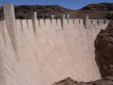
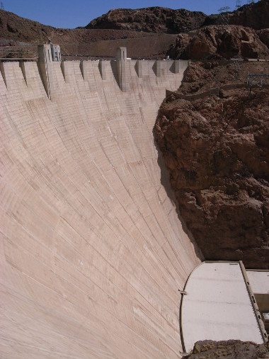
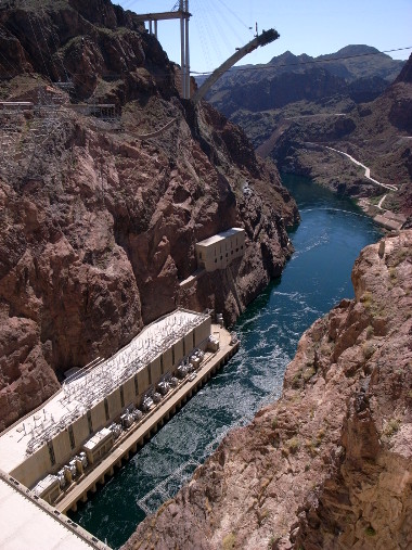
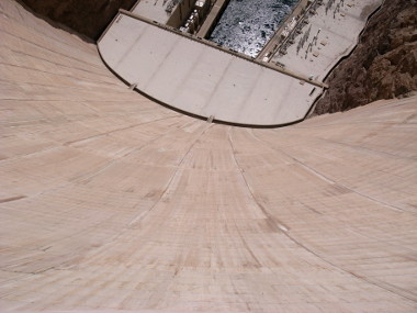
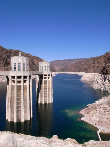
Last weekend Stephanie and I traveled to Las Vegas for a wedding. On the way there we took a detour through Lake Mead. Which meant we got to stop and visit Hoover Dam. And take lots of pictures.
First sight of Lake MeadDam!It’s hard to describe how really big it isColorado river outflow (note the new Hoover Dam Bypass under construction in the background)Still gives me the williesWe walked to Arizona, then crossed to the lake side to see the intake towers. The white “bathrub ring” around the lake is due to mineral deposits from earlier high water periods