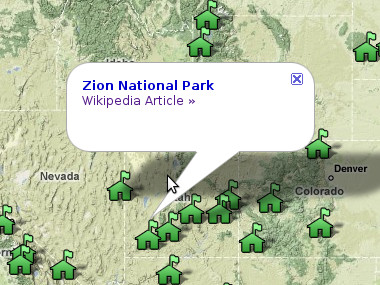
When I start thinking about going on an outdoor adventure, I look to see what parks I haven’t been to yet. When I’m going to be traveling to a new place, I look to see if there are any parks or monuments nearby. The only thing that would make this kind of enterprise easier is if all the parks were plotted on Google Maps.
Turns out Google offers the ability to create these map plugins they call mapplets, as part of their “My Maps” features. Unlike their original Maps API that allows anyone to put a customized Google Map on their site, with mapplets I can modify the core functionality of the Google Maps site itself. And then I can share these annotated maps with the world.
So that’s just what I did:
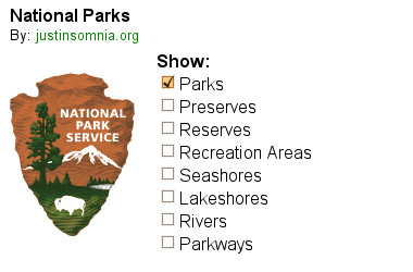
But a map with just a bunch of ranger station icons on it is kind of boring. The whole point of extending Google Maps is being able to add new functionality, not just data. What I really wanted to be able to do is show or hide parks by type.
So I did that too:
Cool huh? Definitely check it out and let me know what you think. Other than the rest of the 391 National Park Service units, what else should I make it do?
We woke at 6am on Saturday morning and began taking down the tent and packing our bags. We hit the trail around 7:30, hiking to the river and then over the Silver Bridge. We followed the river for some time, going up and down more than our sore calves cared to. But eventually we cut back into the inner canyon. The trail intersected with a stream at several points, and we took immense pleasure in dousing our hair and backs with cool water.
The hike up the inner canyon on the Bright Angel Trail was breathtaking. Because we were still below the traditional (and rim-visible) upper parts of the canyon, it didn’t even seem like we were in the Grand Canyon at all, but rather some alternate fantasy world. I kept imagining that we’d stumble upon a dinosaur around the next corner.
We stopped for an extended lunch break at Indian Garden, the halfway point, and the place where I’d previously taken the fork to Plateau Point. From here on out we could see our destination at the top of the canyon, and it seemed very far away and very high. Surprisingly going up felt easier than going down, stressing our quads more than our calves. We still took advantage of the resthouses every mile and a half to rest, refuel, and rewater.
The last mile was hard. Awesomely hard. Like climbing an infinite staircase. Rhythmic. I used my poles to pull my body up every step of the way. This is also the part of the trail where we ran into a lot of people who were just walking below the rim for a bit to take a few pictures. We regaled and amazed them with our tale of starting at the river that morning and hiking 9.6 miles out of the canyon.
Just before the top we stumbled upon a whole family of Bighorn sheep, walking precariously along the canyon walls. And attracting a lot of attention. And then, almost like clockwork, nine and a half hours later, nine and a half miles later, we emerged at the top of the canyon. Victorious!
That night we drove to Williams and celebrated with a steak dinner. Then we continued all the way to a hotel in Phoenix, exhausted, dirty, and sore, but totally satisfied in our accomplishment.
Grand Canyon dawn, crossing the Silver BridgeSee-through bridge! (this one’s for my dad)Long morning shadowsAscending the inner canyonStill smilin’This looks kind of like the Andes, doesn’t it?Looking back towards Indian GardenLooking up towards our destination (the south rim)Amazing light and shadowsGrand Canyon in late afternoon lightWe made it!
I was quite literally holding my camera an inch off of the water. This also shows how we got from one side of the Colorado River to the Bright Angel Campground on the other.
We didn’t do much on Friday except relax. We “strolled” up Bright Angel Creek a bit. We took a dip in the creek to cool off and soothe our sore muscles. We ate a lot of mashed potatoes.
Stephanie and I brought back two backpacking meals from France. Hachis Parmentier for me (ground beef and mashed potatoes), Purée au Jambon for her (ham and mashed potatoes).
Check out our cool sporks
Update: Here’s a proper review, requested by my dad. I thought these were ok, but the Mountain House dehydrated meals we got from REI (Mac and Cheese and Spaghetti with Meat Sauce) were better. And easier to make. These didn’t really have room to add boiling water, stir, and then seal, which made them kind of frustrating to prepare. But once we got the contents emptied into our bowls, it was much easier to mix. Otherwise, they pretty much tasted like mashed potatoes with herbs and little bits of meat. One thing we learned is that rehydration takes time, so it’s worth giving it a few extra minutes so you don’t end up with crunchy meat or noodles.
 Some people are big sports fans. I’m a National Park fan.