mapping the trails off estes
i’ve been playing with terraserver and topozone lately, downloading and splicing together some satellite photos of an area bounded by estes drive (ext), seawell school road, homestead road, and the backs of some neighborhoods northeast of north greensboro street.
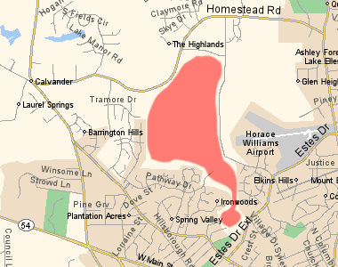
triangle mtb suggests it might be illegal to post information about those trails if they’re on privately owned land. i guess i should find out who owns that land. any librarians out there have any suggestions about how i might do that?
so far the piece de resistance is a full color satellite photo overlayed with the contours of a topographic map. of course i’m not sure what good it’ll do, but it was very cool trying to get the contour map to match the photo, sans-gis. it’s a little too busy if you ask me.
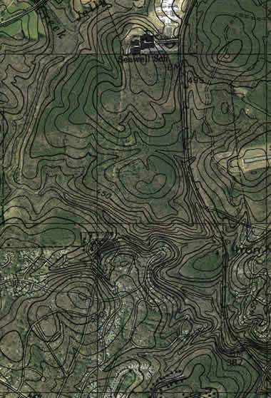
next i’m working on a massive composite image of the highest resolution satellite photos available on terraserver. we’re talking .25 meters per pixel, 800×600 pixels at a time. so far i’ve created a 140MB bitmap image in fireworks that’s 10,000 pixels high and 4000 pixels wide.
this picture is so high res i can actually see some of the trails through the trees. luckily the photo was taken in march of 2002, so the leaves aren’t on the non-pine trees yet.
You should look at National Geographic’s MapMachine (link above). Neat.
Such a relic—I was playing with this a year before Google Maps came out.