On a Saturday about a month ago, Joy, Kyle, Marcia, Stephanie, and I got in a minivan (courtesy of Zipcar) and drove to Yosemite. We took pretty much the whole day getting there, enjoyed a leisurely breakfast, picked up groceries, and stopped occasionally on the way to take pictures. By the time we got to our heated canvas tent cabin at Camp Curry, it was dark.
Upon discovering that cooking inside the tents was off limits—on account of the bears—we “went out for dinner” (for a national park, there are a surprising number of places to choose from). After some made-to-order, buffet-style fare, we called it a night. But before we went to bed, we broke the no-eating-in-the-tent rule and had a few beers.
Of course I made the same mistake of drinking too much on a full stomach right before bed, and sometime in the middle of the night my bladder woke up, begging for mercy. I tried to ignore it, fearing all the hungry bears I’d meet on the long icy walk between our tent and the communal bathhouse, but it was no use. I threw on some clothes in the dark and braved the freezing temperatures for my bladder. Next time: stadium buddy.
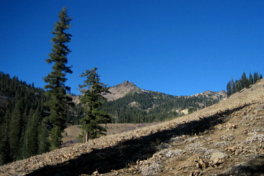
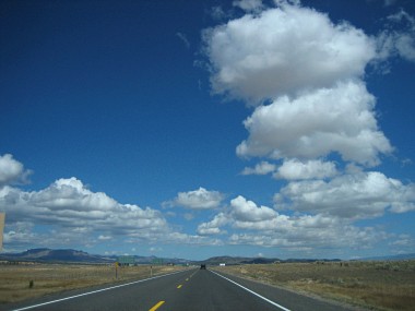
Stephanie in the mini’… vanDashboard group shotClear roads, deep snowObligatory first shot of Half Dome (waaay in the distance)Yosemite Falls in the shadowsSun setting on the valleyHalf Dome sunsetCamp Curry the next morningThe crew all bundled up for the day’s adventures..En route to Badger Pass for some snowshoeing to Dewey Point
After discovering our Zipcar had a dead battery and waiting for someone to come pop the lock and “boost” it, Stephanie and I drove up to Healdsburg (along with everyone else in northern California) to pick up Jean-Claude and Sabine and head north to Lassen Volcanic National Park.
Getting from Healdsburg to I-5 is not exactly a straightforward endeavor, but from there it was pretty much a straight shot up to Red Bluff, where we exited onto CA-36 towards Chester.
As soon as we arrived at the hotel, I plugged in the crockpot to start heating up the Thanksgiving gumbo we made from scratch the night before. In the meantime we cracked open a bottle of wine and started playing Apples to Apples. The gumbo was good, very hearty, great with the pre-cooked wild rice we’d brought along from Trader Joe’s.
Friday morning we took our time getting up (yay vacation!), bundled up (it’s cold here!), and headed in the direction of Lassen (volcanoes!). Lassen felt practically abandoned. There was no one at the park entrance, and the trailhead/campground parking lot after the entrance was blocked due to construction.
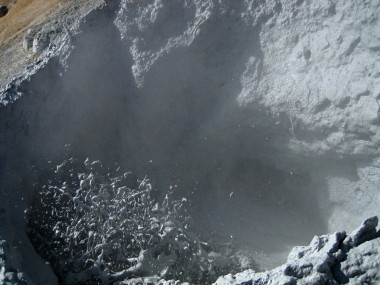
We could only drive on the road through the park up to the Sulphur Works—the road beyond that point had recently been closed for winter, rendering a majority of the sights (including the radly-named Bumpass Hell trail) inaccessible until next summer.
But we did get some neat sights (and smells) of a few steaming and gurgling sulfurous thermal vents. This one in particular sounded like a demonic washing machine, and occasionally burped up some gray goo.
After some indecision about what to do next, we invented a parking spot near the park entrance, and crossed over some “hard hats required” barricades to get to the Southwest trailhead. From there we hiked about 1.6 miles down to Mill Creek Falls, which we caught illuminated in the near perfect mid-afternoon sun.
A perfect spot for lunch, but we didn’t rest long because it got pretty cold when we weren’t moving—the temperature was in the 30s and most of the ground was frozen. And so back out we hiked.
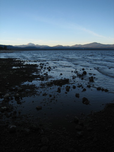
On the drive back to Chester we took a detour to peek at nearby Lake Almanor. Very picturesque at sunset, but very cold and windy in November.
When I first visited Zion National Park a little over 2 years ago, I hiked the Angel’s Landing trail on the advice of some people I bumped into while driving from North Carolina to California. That was and still is one of the most awesome and most psychologically challenging hikes I’d ever attempted.
Which raised the obvious question: how to top that? One idea Stephanie had was a horseback ride through through Zion. Her knee was bothering her after our Bryce excursion, so anything that limited the ups and downs was a good thing. There were 1 and 3 hour long trips we could take, but we were having trouble deciding how long and what time to start.
We also had another constraint. As this was on Friday of our trip, we needed to be in Las Vegas by 6 at the latest to pick up the tickets for a Cirque du Soleil show we’d planned to see that night. Given the 2 and a half hour drive from Zion to Las Vegas and an advantageous time zone change, we had to leave the park no later than 3. And given that we were staying at a bed and breakfast, we had the obligatory breakfast at 8:30am—which in the very least ensured that we got up early.
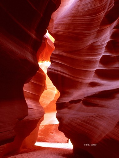
So we decided to nix the horseback ride—it seemed too limiting, something to do next time. Instead Stephanie was inspired by an uncaptioned picture she kept seeing on postcards and in the Zion Park brochure of a slot canyon.
Typical slot canyon shot of Antelope Canyon by B.E. Butler
Thursday was another travel day. We left Bryce around noon after a much needed shower and some internet time, heading towards Zion National Park, which Google Maps estimated would take about 2 hours.
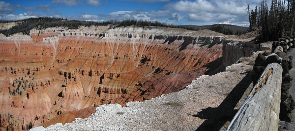
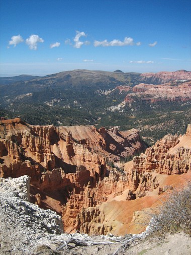
However, en route we decided to turn off on UT-14 towards Cedar Breaks National Monument, which we’d seen described in some geologic diagrams as pretty awesome.
It was above 10,000 feet in elevation and very windy that afternoon. Imagine standing at the edge of the Grand Canyon, without a railing. We took a 1 mile hike along the rim to another overlook—of course the whole trail was something of an overlook. At some point I felt the need to walk in a crouched position because the trail was eroded and slanting into the canyon.
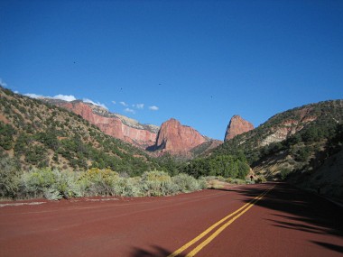
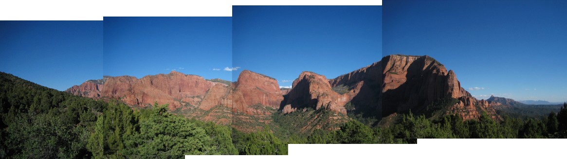
After that diversion, we got back on the road towards I-15, had lunch in Cedar City, and then headed south to the north entrance of Zion to check out the Kolob Canyon. After a quick driveby, we continued on our way to Zion proper, only to discover most of the hotels in Springdale (just outside the park) were booked. So we turned into the first bed and breakfast we saw had vacancy, a very cute place called Under the Eaves run by a British couple. Highly recommended.
The sun was setting, and we were pretty tired, so we decided to just chill at the B&B, drinking a bottle of wine outside in the surprisingly warm desert air.
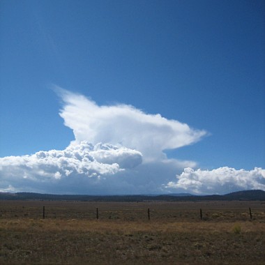
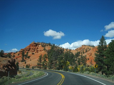
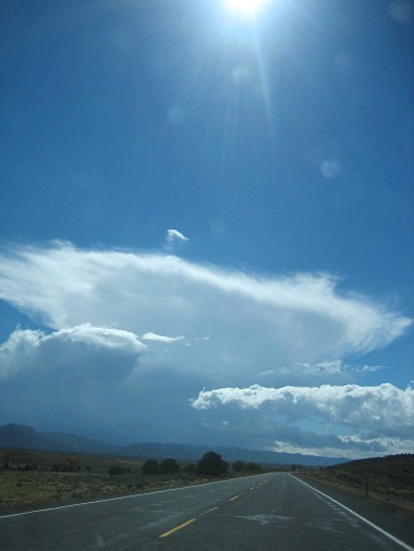
The road out of BryceCrazy cloudDriving through Red CanyonCrazy cloud developingCedar Breaks PanoramaLooking into Cedar BreaksApproaching Zion’s Kolob Canyon
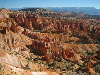
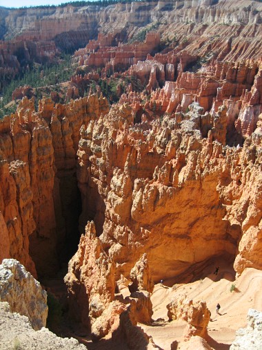
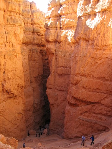
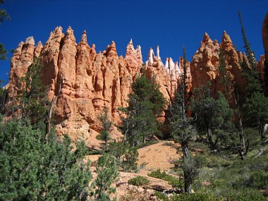
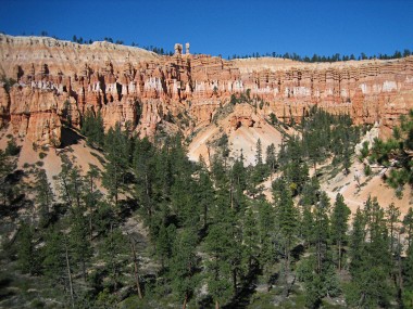
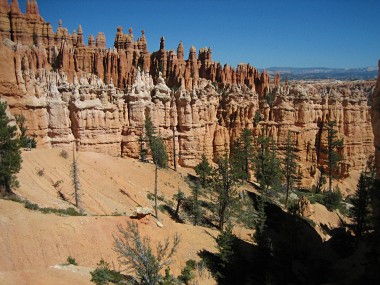
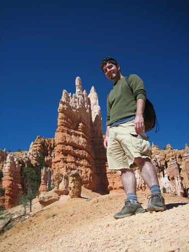
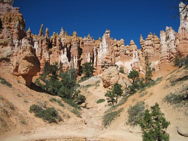
Given our many hiking options at Bryce Canyon, I was leaning towards a strenuous route informally called the Figure 8, a combination of three different trails that covered over 6 miles in an estimated 4-5 hours. We started at Sunset Point (best viewed at sunset) on the Navajo trail, which brought us immediately down into the canyon via a serious of switchbacks, and through a narrow gap called Wall Street, featuring some tall trees growing right out of the rock.
We then caught a connection over to the 3 mile Peekaboo loop, so-named we learned by experience because the trail had many ups and downs. Amazing views—but also pretty exhausting. I’d love to know the gross elevation ascended, not just the net. About half way we stopped for lunch, heated up some pre-cooked lentil rice biryani I imported from Trader Joes. And enjoyed a break.
We finished the loop and then caught the flatter Queen’s Garden trail all the way around to the Sunrise Point (best viewed at sunrise) somewhat quicker than we expected. The trail is named that because there’s a hoodoo shaped like Queen Victoria in profile towards the end.
It was late afternoon when we finished, so we took a break from nature to get some internet time in outside the General Store, updated my blog, and researched our options for Thursday.
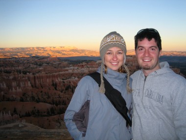
First view of Bryce CanyonLooking down at the Navajo switchbacks towards Wall StreetDescent towards Wall StreetLooking up at the hoodoos along the Navajo trailBryce amphitheater from the Peekaboo trailThe “wall of windows”Hoodoos come in many different colorsMe at Queen’s GardenQueens Garden (Queen Victoria hoodoo not pictured)Stephanie and Justin at Sunset Point (at sunset)