We made it to Yosemite, finally!
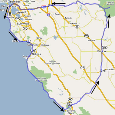
To recap: On Friday night we left San Francisco, bound for Watsonville, stopping at Santa Cruz along the way. On Saturday we drove through Pebble beach and continued on our way down the Big Sur coast, all the way to San Simeon. On Sunday we skipped Hearst Castle for Morro Bay, and then on a whim, made a beeline for Yosemite.
That night we had dinner in Fresno at an unusual restaurant chain I’d never heard of, before continuing north on CA-41 towards Yosemite National Park. Fingers crossed that we’d be able to find a place to stay. Stopped at the first (and last) city before the park: Oakhurst; stopped at the first hotel we saw, which advertised free wireless internet (hooray!), and which apparently had the only vacancies left in town; posted my first dispatch from the road and crashed, alarm set for early.
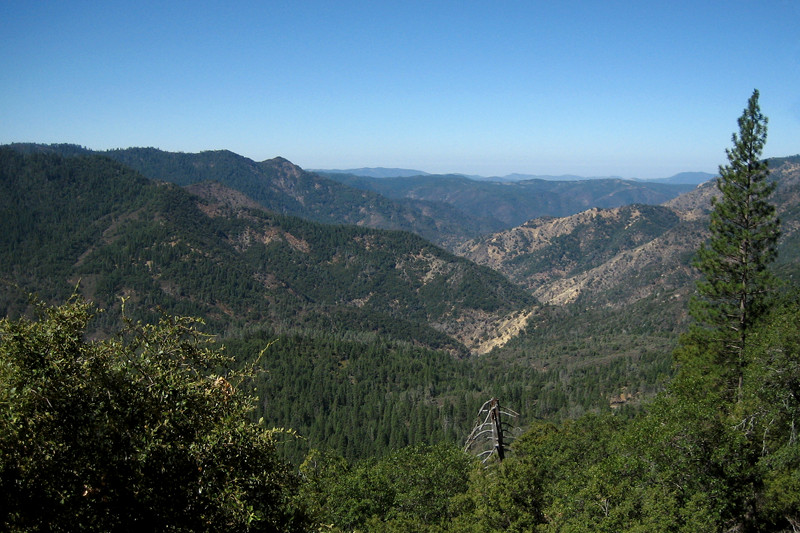
At some point north of Fresno, it became a lot hillier and woodsier, but we hadn’t seen the transition traveling in the dark. So our drive towards and into the park Monday morning was a welcome departure from the flat Central Valley of the previous day.
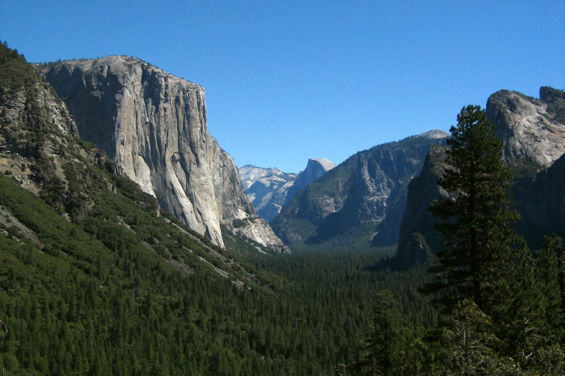
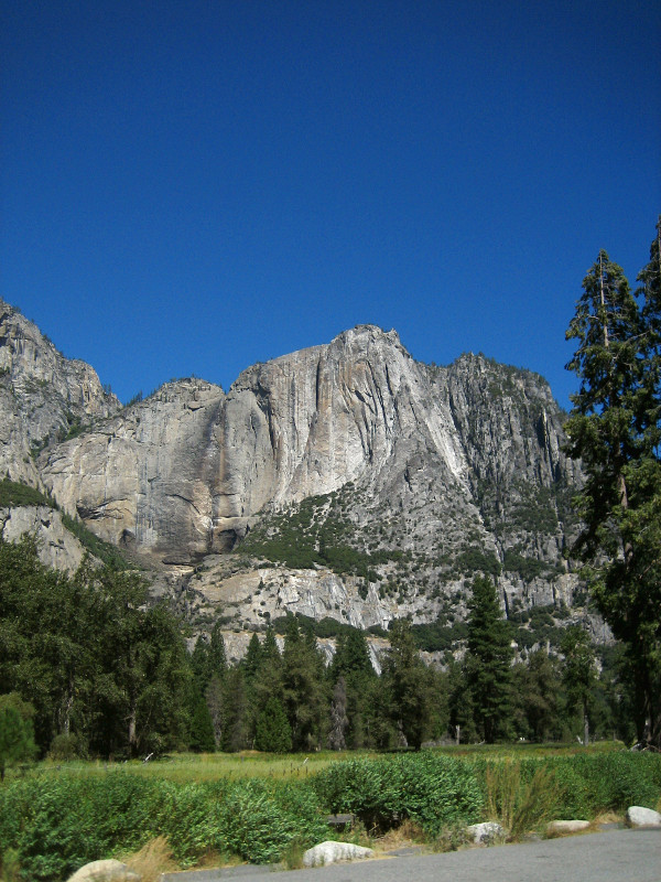
After driving through a very long and rugged tunnel, we emerged at the classic “tunnel view” of Yosemite Valley towards Half Dome.
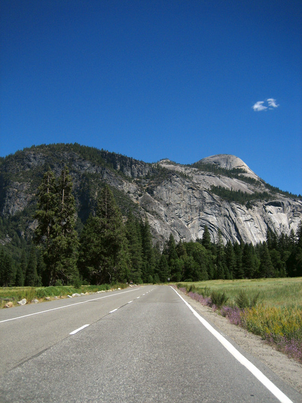
Yosemite is big. Pretty much all the photos I took were vertically oriented. We took lots out the car as I drove through the park, passing by smarter (read: safer) drivers who’d actually pull over to photograph what they were seeing. However we were in a bit of a hurry to get our hike on.

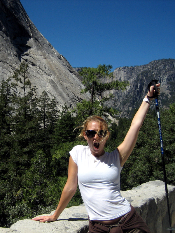
After reading up on the park the night before, we decided that the 10-14 hour trek to the top of Half Dome and back would require a little more advanced planning and chutzpah than we had bargained for, so we settled on the Mist Trail to Vernal Fall and then down and back again.
This trail was no joke. As soon as we got on it, it started taking us up. Straight up. Breaks were frequent.
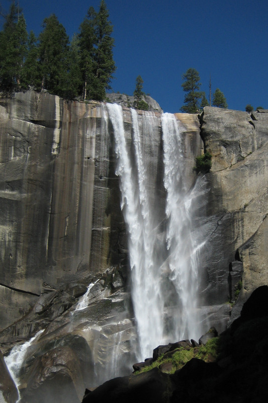
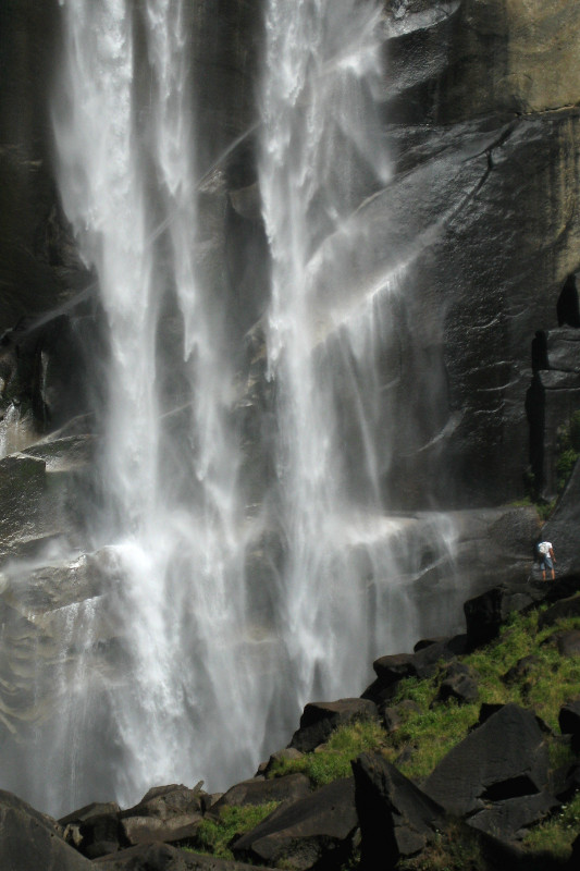
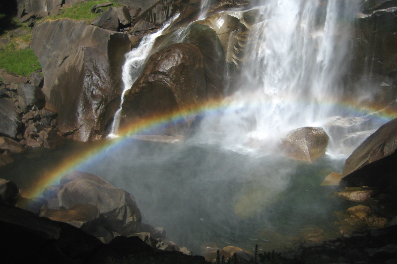
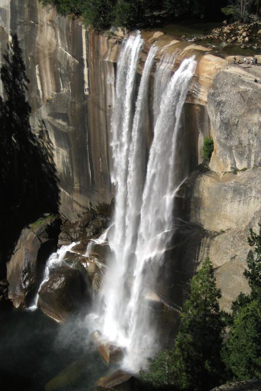
So I figure, why not get a little closer and actually feel the fall? It’s just a little ways off the trail. Though there wasn’t a torrent of water flowing, the sound it made hitting the cliff wall was something akin to a jet engine. And the mist it threw off sporadically made it difficult to capture what I eventually found at the bottom: a rainbow!
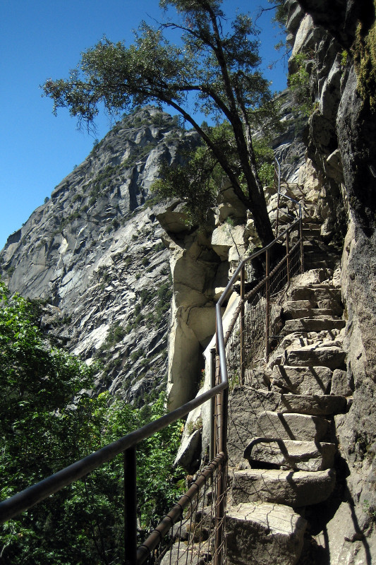
After a little scrambling through the mud to get back on the trail, we climbed countless steps all the way to the top of the waterfall.
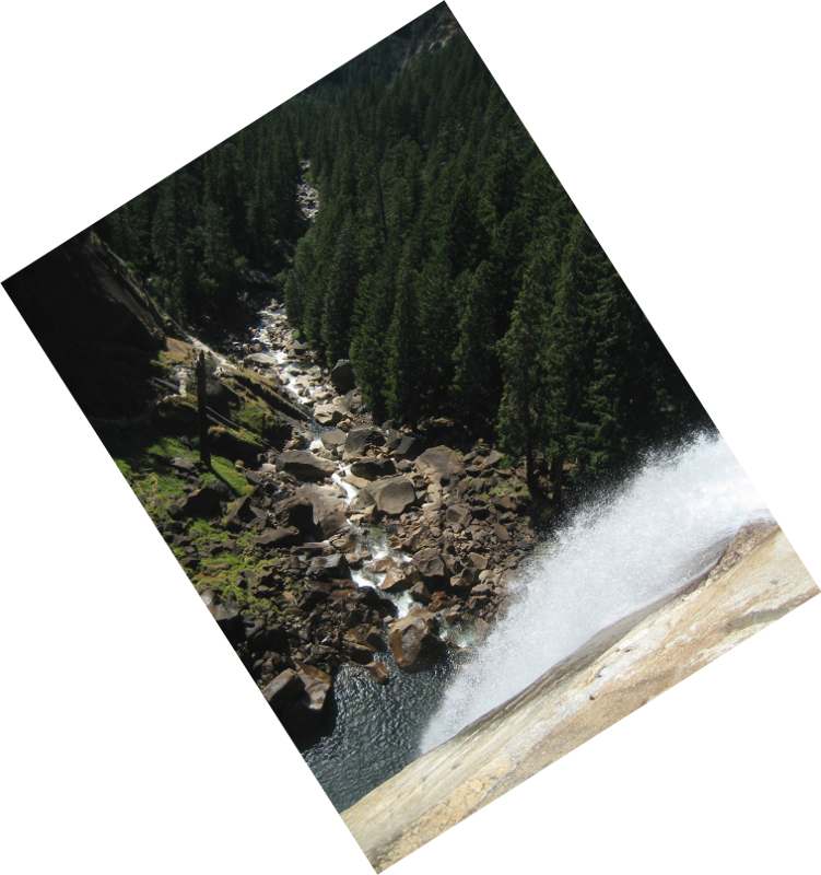
After resting and snacking we began the loop back around, thinking that the top of the fall was as high as we were going to go. Oh, no—the trail continued upwards, eventually cresting at an amazing overlook, well above Vernal Fall. Look how tiny those people are!
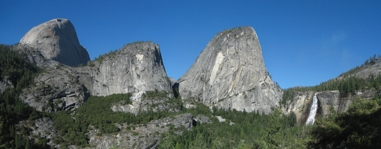
Panorama looking toward Nevada Fall, with Half Dome on the left
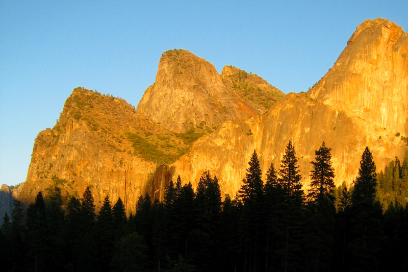
The trail on the way back was quiet. We were the only ones on it except for a speed-hiking father-son duo. The quality of light against the mountains was tremendous as the sun started dipping below the valley walls. Everything that had been shimmering blue-gray now reflected yellow-orange.
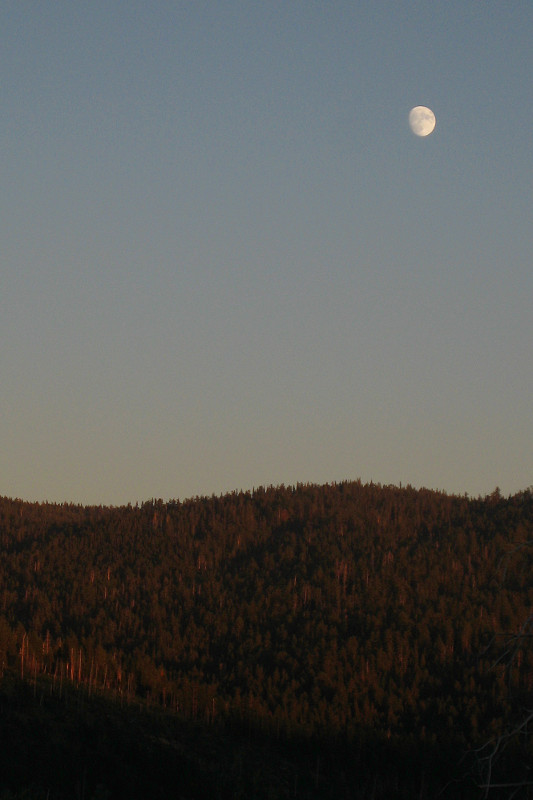
We left later than we’d planned (we still had a four hour drive back to San Francisco that night), but we got to see the sun set and moon rise over the park. Just outside the park we stopped in the pornstarishly-named town of Buck Meadows to chow down. I had a well-deserved chicken fried steak, Stephanie a juicy burger.
After a long drive after a long day after a long weekend, we made it home to the city after midnight.
How long is the drive from Morro Bay to Yosemite?
Google Maps says it should take just under 5 hours. I don’t exactly remember how long it took us.