How to Coordinate a Supported Thru-Hike
It started with a spreadsheet. For his attempted northbound thru-hike of the Continental Divide Trail (CDT) in 2016, Dad cataloged the towns where he planned to resupply, i.e., buy food, mail food to himself, and/or pick up food he’d mailed previously. Sometimes the trail would meander right through the center of town, but most of the time he’d have to roadwalk or hitch, often a great distance from the trail. Generally he’d aim to resupply every 80–120 miles (or every 4–6 days at a 20 mile-per-day pace).
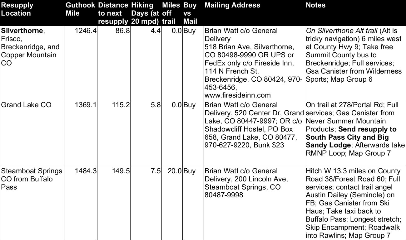
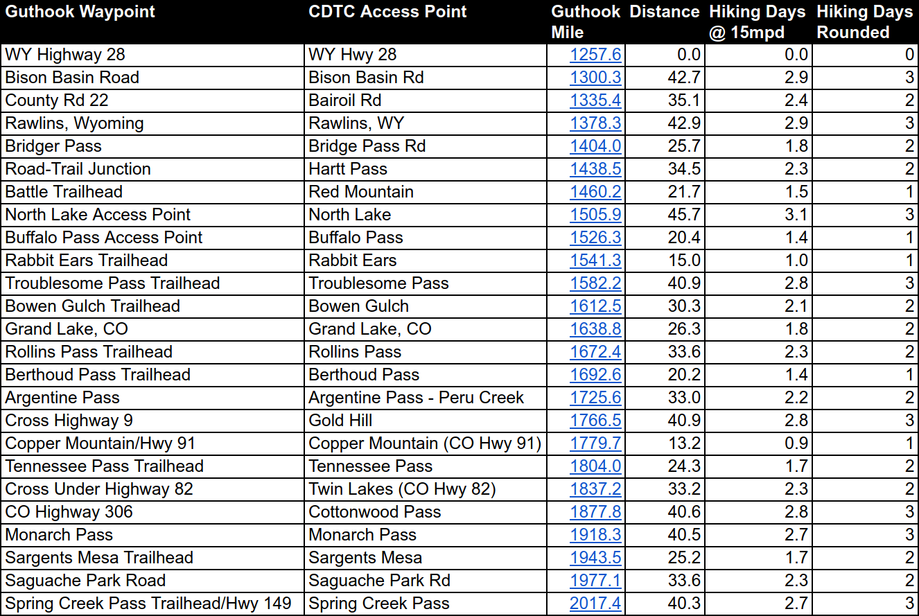
After he committed to the idea of a supported, thousand-mile section hike, I took his 2016 plan, copied it over to Google Sheets (so that we could both view and edit it remotely), reversed the order (as he’d be hiking southbound), and removed everything north of South Pass City, WY (near his starting point on WY-28) and south of Cuba, NM (where he bailed in 2016). I presumed that Dad would stick with the same cadence of resupply stops, meeting up with me every 4–6 days. He presumed that I’d be bored out of my mind, and so wanted to meet up every 2–3 days, hiking at a conservative 15 mile-per-day pace. It’s no coincidence that this would also allow him to carry half as much weight in food. The challenge was finding additional places where I could reach him with my Jeep. For this, he turned to the CDT Coalition’s Interactive Map, which had “access points” plotted along the trail (that we hoped had been vetted).
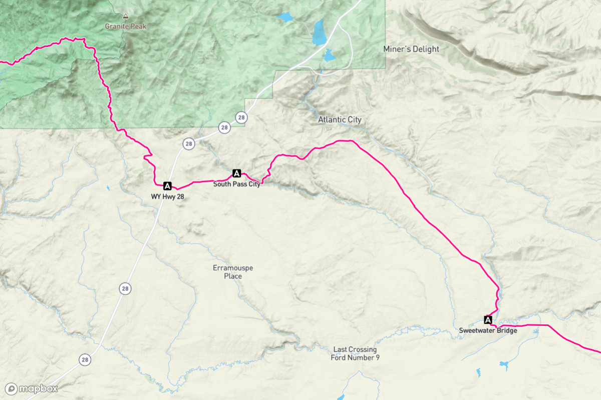
This solved one problem but created another. The “standard issue” app for thru-hiking is Guthook Guides. Its key feature is the ability to indicate your location on a variety of offline maps (using GPS while on airplane mode) with the trail plotted as a bold, red line. Given Guthook’s partnerships with a number of trail organizations, it has become the system of record for most long trails. Which means that knowing where you are requires knowing what Guthook mile you’re at (or near). To unambiguously communicate about our meetups, we both needed Guthook’s CDT maps, and we needed to know the Guthook waypoint and its southbound mile number for each meetup location. Unfortunately, the CDT Coalition didn’t include the Guthook mile with their access points (nor did they use the same placenames!) which meant Dad had to painstakingly compare the shape of the trail between the CDT Coalition map on his computer and the Guthook map on his phone to find the waypoint (and thus the mile) for each access point. It was this way that he added an additional 24 meetups to the original 12 that I copied over from his 2016 plan.
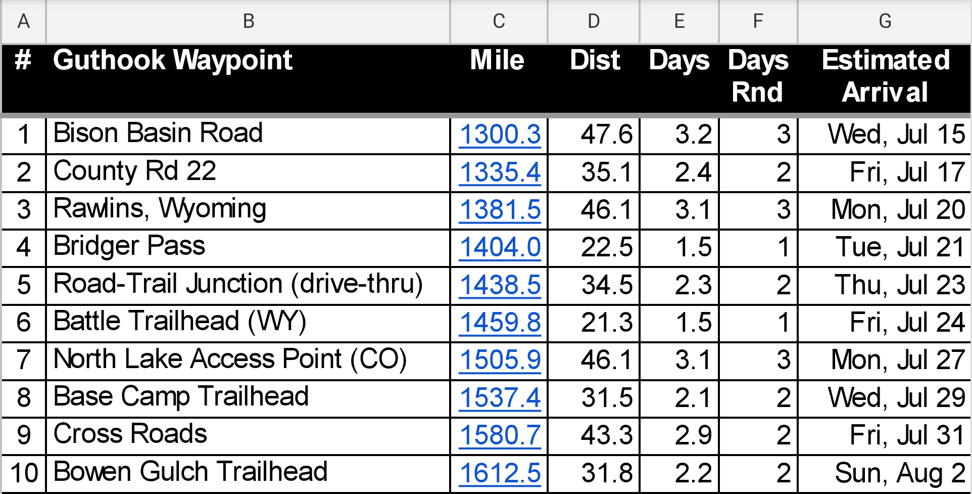
Though we carried printed copies of the new plan with us, I also set it up as an offline Google Sheet on my phone. This allowed me to easily review our upcoming meetups, calculate distances, and modify the plan at will (adding, removing, and updating meetups, adding an “estimated arrival” date column, graying out completed meetups, etc.), all without cell signal.
The CDT Coalition’s map had links to Google Maps with high precision GPS coordinates for each access point, which Dad added to the spreadsheet. (As an aside, Guthook on Dad’s iPhone also displayed each waypoint’s latitude and longitude, while my Android version of the app did not—something that would have been handy for planning.) In practice I depended heavily on Guthook’s “Google Navigation” integration to get me from meetup to meetup. How did I locate the waypoint for each meetup in Guthook? If it had a unique, descriptive name, like “Bison Basin Road”, I could search for it, no problemo. However good luck finding the right “Road-Trail Junction”—I might get dozens of results to scroll through. What I could not do (for no obvious reason) was search for the mile number itself! Often I found it easier to just tap on a random waypoint and then swipe farther up or down the trail while zooming in and out to narrow in on the one I was seeking. Once found, I’d tap on “Google Navigation” in preparation to drive there, but Guthook automatically defaulted to walking directions. When I had signal, this required that I reflexively exit out of Google Navigation, which dropped me back to the directions in Google Maps, then I’d select driving directions and restart Google Navigation. When I was in airplane mode, which was most of the time, Google Navigation for walking would fail, so I could select driving directions in Google Maps from the start, start Navigation, and I’d be off to the races.
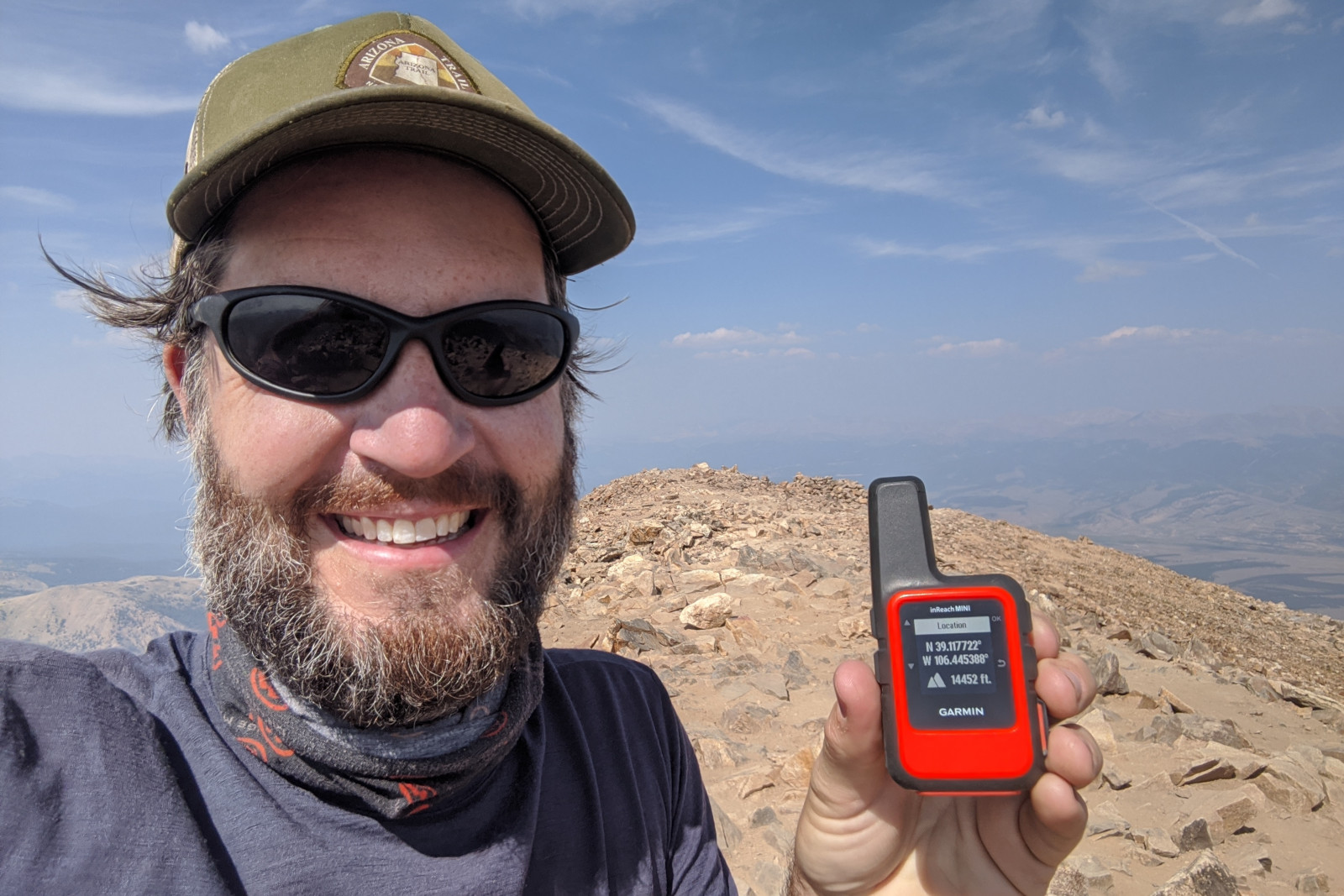
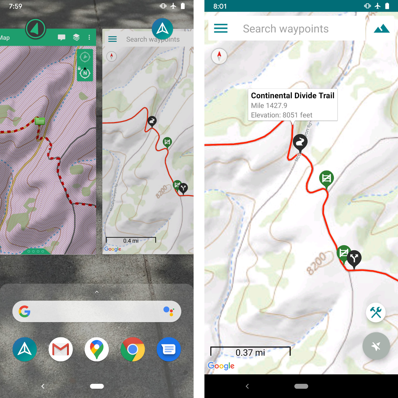
Our spreadsheet plan told us where to meet, and Guthook told us where we were, so the last piece of the puzzle was staying in communication with each other. For this, we both brought Garmin inReach devices (acquired for previous thru-hikes), which not only allowed us to inform the outside world of our daily position, but also communicate with each other via 140-character text messages. Each message conveyed our current GPS location, which we could view on a map within Garmin’s companion Earthmate app. Most of the time, however, we relied on preset messages to broadcast “I’m ok…” along with our location. In these cases, I was confronted with a familiar problem—I knew where Dad was on the map, but not what Guthook mile he was at. It turns out that Guthook (circa 2020) cannot plot an arbitrary latitude and longitude coordinate from an external source, say, someone’s inReach message, in order to determine what mile they’re at, and thus how many miles they have to go, what’s their ETA, and what their morale might be as a result. This functionality seems both so obvious and critically important that I emailed the Guthook team to make sure I wasn’t missing something (I wasn’t) and to make a case for the feature. As a workaround, I got pretty good at matching the shape of the trail between Guthook and Earthmate using Android’s app switcher. A quick tap on the trail (when not at a waypoint) would bring up an infobox displaying the mile. Then all I had to do was get to the next meetup (easier said than done at times, but a task for which the Jeep was uniquely suited), sit back, and wait for Dad to holler when he showed up.
And it should be pointed out that for all of the 36 meet-ups we were successful, that is, we never lost or missed each other in over 1000 miles of wilderness.
Yes, that’s right!—even on the 2 or 3 occasions where I “called an audible”, updating the meetup to a new spot and informing you en route via an inReach message.