Rim Fire in context
I stumbled upon this interesting map from the Modesto Bee which Jeff Jardine linked to from his column, What’s new is old again as Tuolumne blaze revisits old scars. It’s a map I’d not seen published elsewhere, so I thought I’d share it here.

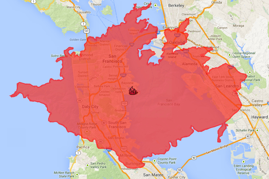
Update: To gain a better appreciation of the scale of the fire, I overlaid the perimeter as of August 28 on top of San Francisco.
For more, check out ESRI’s neat interactive map of the fire.