Into the Desolation Wilderness
Ah, a relaxing Sunday. Body’s a little sore, as Stephanie and I spent Saturday hiking into Desolation Wilderness, southwest of Lake Tahoe. We’d earmarked Saturday to help out her dad and Sabine with a garage sale, but turns out they didn’t need us, so we got home from work on Friday without anything at all planned for the weekend.
Stephanie was thinking Yosemite, the same idea occurred to me too, but fearing it’d be crowded and/or hot and/or hard to find a place to stay on a moment’s notice, we started thinking about some out-of-the-way places like King’s Canyon or Sequoia. Lake Tahoe also came to mind, but without the centralized resources of the National Park Service, we didn’t really know where to go or what to do (first). Searching around for Lake Tahoe hikes eventually that led us to Desolation Wilderness, something I’d briefly read about before.
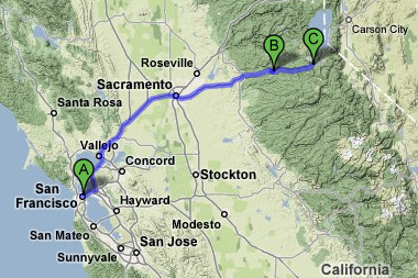
With a loose destination in mind, we got ourselves a hotel room for the Friday night, rented a Zipcar for 7:30pm (it was just about 7) and started pulling together our hiking gear. Not more than an hour after we’d gotten home from work, we were out the door and on our way towards South Lake Tahoe.

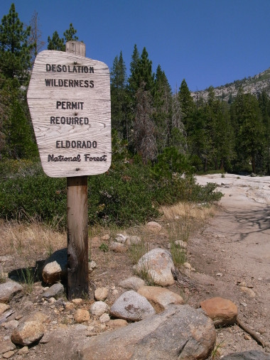
We spent the night in Pollock Pines, got a map and free day use permit from the Forest Service Ranger Station (though it turns out we could have self-registered at the trailhead), and continued east on US-50 towards the Pyramid Creek Trailhead. From what I’d read, the best first thing to see was Horsetail Falls, which seemed to offer some opportunities for doing a little hiking off the beaten path.
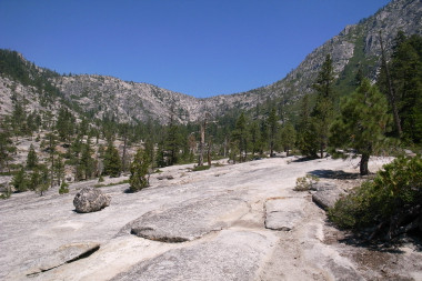
The trail on the map was marked as 1.4 miles long, the first half of which was maintained, the second half (to the base of the falls) was apparently unmaintained, with a total elevation gain of about 760 feet. After that there were no “official” marked trails, either on the map or on the land, other than the Falls itself and Pyramid Creek above the falls connecting a series of lakes. After a brief lunch overlooking a series of emerald pools at the base of the falls, we continued up along the falls, following a loose set of rock cairns and the occasional “unofficial” painted arrows.
After a long hard hike, somewhere between bouldering and hiking, we made it to Avalanche Lake at the top of the falls. We continued further to Pitt Lake, but with no clear route in sight, and a few dead ends, we decided it’d be best to head back rather than go any further. Which meant we had to figure out how to get back down the rocky mountainside we’d just ascended. Suffice it to say, we were sore, and it was hard. Once we made it to the pools where we’d stopped for lunch, we took a lovely break to stick our bare feet in the icy water. We eventually made it back to the car, thoroughly exhausted, and began the drive back to San Francisco.


Update: over on White Noise Lounge, I just posted a recording of a Gurgling mountain stream from Desolation Wilderness.
how close to the edge of the falls could you go?
It wasn’t so much an edge as a gradual slope that got steeper and steeper. But we were pretty close to some pretty steep parts as Stephanie will attest.
I confirm… we were pretty close to some steep edges. The falls like Justin mentioned were more like gigantic water-slides that kept bouncing off rocks and little pools. I don’t know if I’m describing this right, but it was stunning and well worth the occasional goosebumps.
I just did this hike yesterday and confirm all you said. Sore, but feel pretty darn good for getting up there. There is nothing like pounding the granite to feel alive on the planet. Yeah.
Heh, that rhymes. Glad you enjoyed.