Since we had all of last Sunday to head home through Yosemite from Mono Lake, and since the weather was absolutely gorgeous, we figured, why not stop somewhere around Tuolumne Meadows for a hike? (Finally learned from a ranger that Tuolumne is pronounced to-ALL-uh-me, the “n” is silent.) Unfortunately Stephanie’s allergies were reaching category-5 stage, so we opted for a less strenuous (or so we thought) hike up Lembert Dome, an 800 foot high granite dome that rises right up out of the meadows.
The hike through the woods from the Dog Lake parking lot was entirely pleasant, and eventually we emerged on the eastern flank of the gradually sloped dome at the same time that a ranger was leading a group up. We orbited the group, taking pictures and appreciating the view of the surrounding mountains now that we were out of and above the trees.
As it turns out, getting to the top of the dome was not obvious. From the road it looks like child’s play, but when you’re on it, the top is like a mini dome on top of a dome. The bottom dome is just steep enough that every edge feels like a cliff, and getting from there onto the top meant scaling up an even steeper section. You can imagine our amazement when the ranger and his group of mostly older visitors just walked/scrambled up the steeper section, to the point where they were no longer visible.
Had we not seen them go up, we probably wouldn’t have thought it possible, but now watching them nonchalantly walk up and down the rock face made us even more nervous. Seeing Stephanie reach her limits made me nervous which in turn made her more nervous. We decided we’d gotten as far as we were willing to go. We rationalized that the views from the tippy top were no grander than the views that were giving us butterflies, so we carefully managed to work ourselves off of the steeper section we’d been perched on, which was probably the hardest part.
Once we were on flatter rock, we felt completely fine. Stephanie almost suggested that we try again (I think more wanting to appease me), but I assured her that it was just as scary for me. Maybe next time.
Heading back up the scenic Tioga Road……towards the Tioga PassApproaching Lembert DomeA lone pine—notice how the edge kind of curves awayThis should give you an idea of how steep it was“Ok, I’m done, get me outta here!”And yet it doesn’t look that bad from a distance
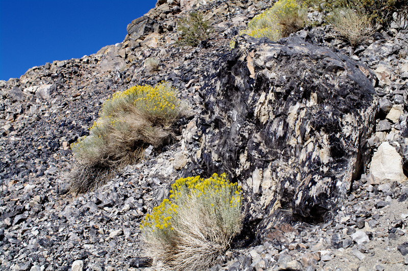
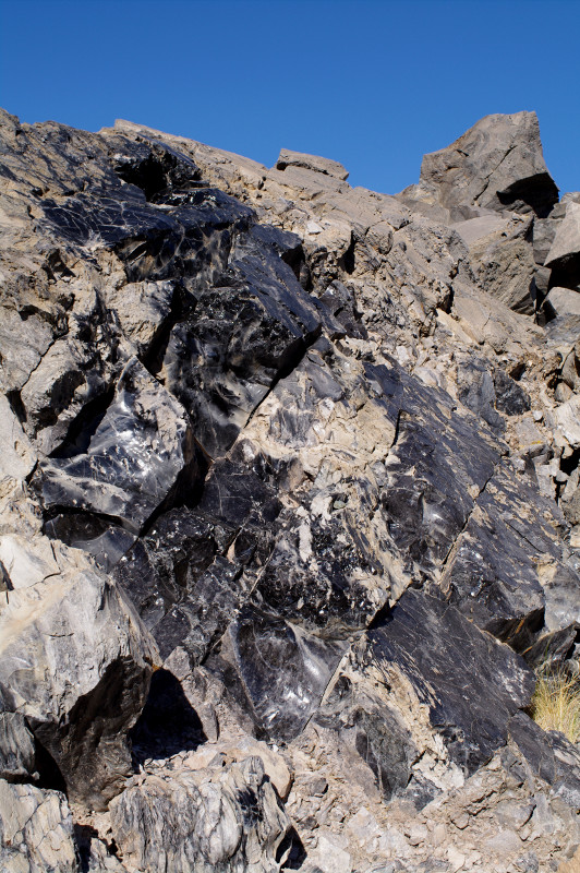
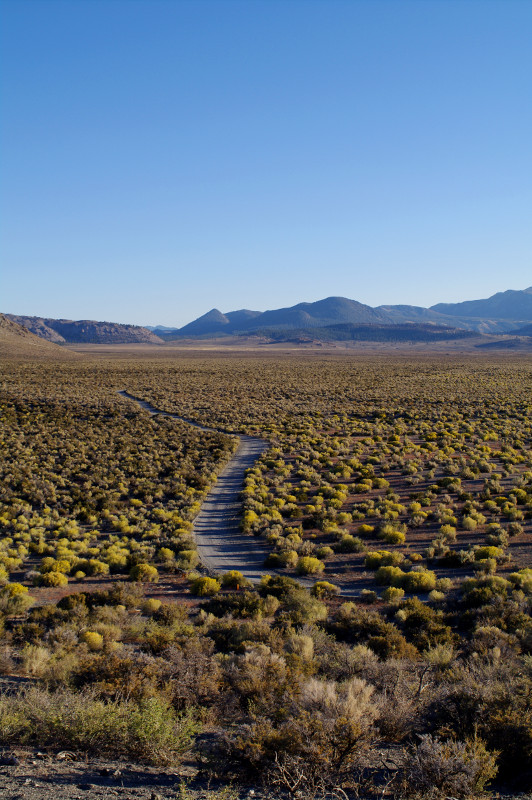
In between checking out the Mono Lake tufas in the early afternoon and then catching them at sunset, we drove over to Panum Crater, “a perfect example of a rhyolitic plug-dome volcano”. It’s one of a series of craters that form the youngest mountain range in North America.
While we were hiking through it, it just seemed like a big pile of rocks, but from the air, its shape is really quite impressive. What stood out from the Cinder Cone we hiked in Lassen were these massive pumice boulders that were almost glazed with obsidian, like pottery. It’s hard to believe that we were standing on a spot that only a few hundred years ago was hot enough to melt rock into glass.
Obsidian-splattered boulderHuge chunks of obsidian
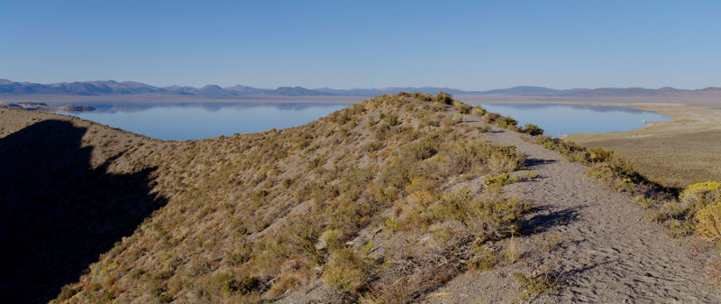
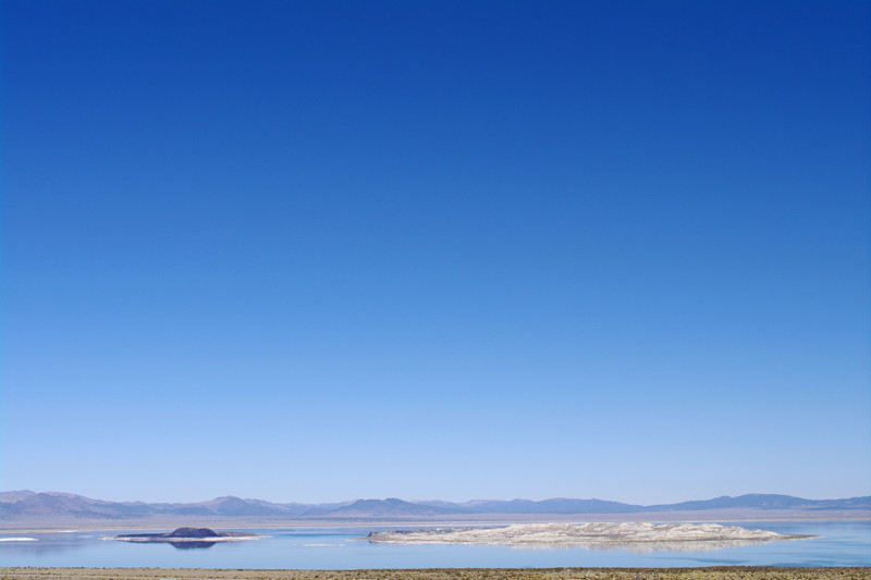
Panorama of Mono Lake from the rim of Panum Crater
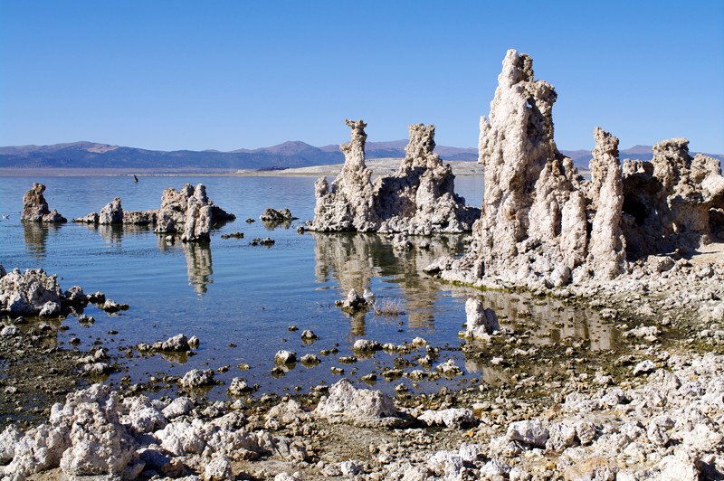
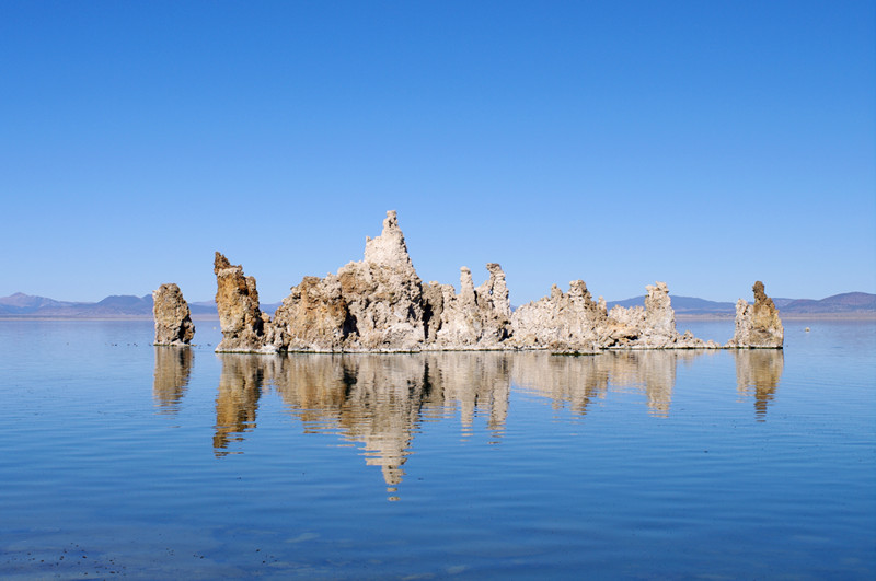
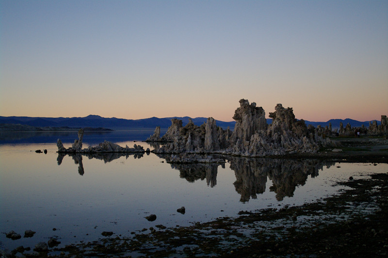
Last weekend Stephanie and I ventured all the way through Yosemite to get to Mono Lake on the other side. We didn’t really have a reason to go, except that it was there. After stopping for lunch in the town of Lee Vining, we went to explore the Tufa rock formations in the south of the lake.
Tufa, a type of calcium carbonate, is formed when mineral-rich springs under the lake react with the alkaline lake water. The towers that are currently visible all used to be hidden under the surface of the water—where they form—until 1941, when fresh water sources that fed the lake were diverted to the city Los Angeles. This caused the lake level to drop 45 feet, from 6,417 feet above sea level to 6,372, thus exposing the tufas.
Unfortunately this also had a disastrous effect on the unique ecology of the lake. It increased the salinity of the already hypersaline water, threatening the lake’s 4-6 trillion brine shrimp, a vital source of food for migrating birds, it created land bridges to islands in the lake where birds used to nest, exposing them to predation, and it exacerbated alkali dust storms due to the exposed lake bed.
In 1994, after a 16 year legal battle, an agreement was reached to restore the lake to a goal of 6,392 feet above sea level. It’s currently somewhere around 6,382. It’s very likely that when it reaches 6,392 feet, the tufa towers we saw will once again be under water.
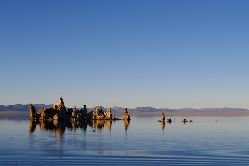
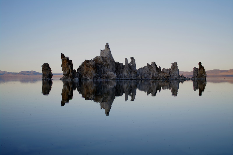
Tufas visible at the edge of Mono LakeAn island made of tufasWe returned at sunset (I love the ripples in the enlarged version)The reflection makes it look like a Rorschach inkblotTufas at dusk
After a week of waking up at 4am, 5am, and 6am and going to bed at 8pm, 9pm, and 10pm, you’d think we would have spent our first weekend back from France just chilling. Nope. After work on Friday we picked up a Zipcar and started heading east. We made it to Groveland, about 140 miles west of San Francisco before stopping at a cheap motel for the night.
We got going early the next morning, on our way towards Mono Lake through Yosemite. Previously we’d entered the park from the south to visit Yosemite Valley, and from the west to go snowshoeing near Badger Pass, but we’d never driven across Yosemite through the Tioga Pass, California’s highest road at 9,945′ above sea level.
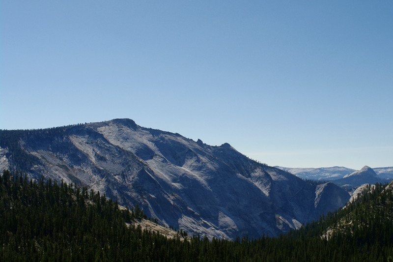
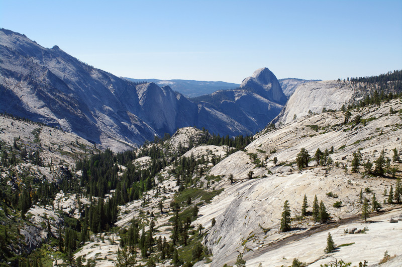
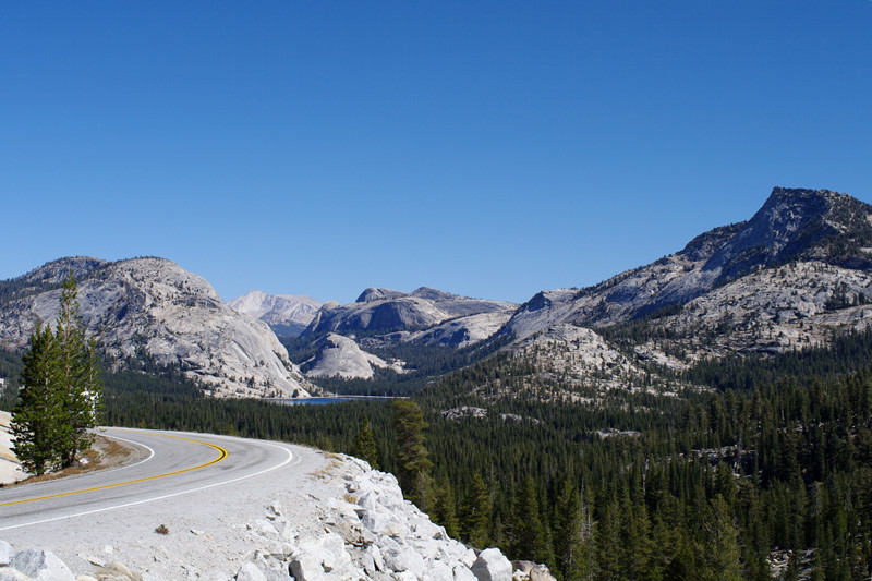
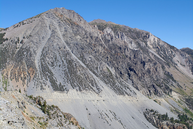
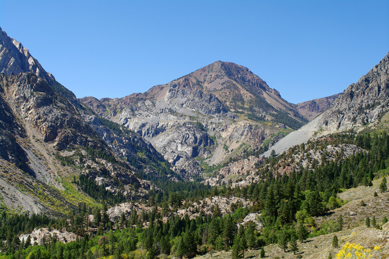
Though Mono Lake was our intended destination, it was impossible not to stop along the way in Yosemite. The weather was just perfect, in the high 80s, and the skies were absolutely clear. We saw Half Dome from Olmsted Point, the stunning Tenaya Lake, and of course the Tioga Pass. We made it to Mono Lake around lunchtime, so we stopped in at Bodie Mike’s BBQ in Lee Vining before heading out to explore further.
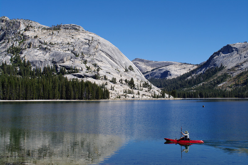
View from the Tioga Road in YosemiteHalf Dome from Olmsted PointSliver of Tenaya Lake visible from Olmsted PointKayaker paddling through Tenaya LakeEastern part of Tioga Road, heading down towards Mono LakeLooking back towards the Tioga PassFirst sight of Mono Lake
Note: I’m experimenting with adding larger versions of the photos on my blog. Each of the 380px wide images in this post links to an 800px wide version. If you’re viewing this post on my blog directly (as opposed to in a feedreader) clicking on the image should display the larger version with a sexy animated transition. Please let me know what you think.
Update: As of my Responsive Redesign in May 2015, I’m displaying the large version of photos in my posts, so I’ve removed the ability to click on the photo to enlarge it, which no longer had any purpose—and wasn’t very effective on touchscreen devices.
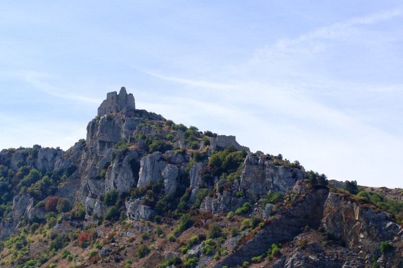
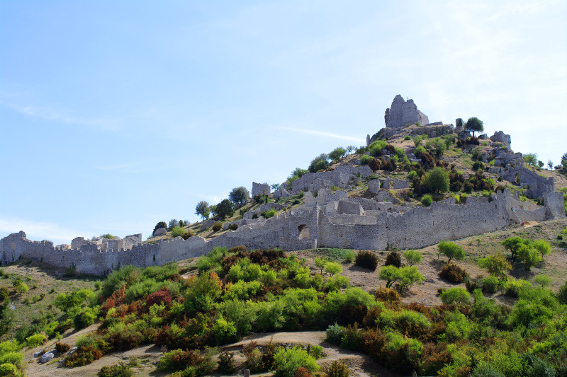
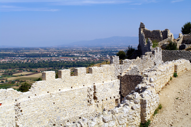
I feel like I have to remind myself that “Europe is where castles are from”. We don’t have any medieval castles in North America, outside of renaissance faires and fantasy novels. But in France, castles, and especially ruins of castles are pretty much a dime a dozen. Whether driving through the middle of nowhere or along the highway, I’m always amazed to spot a hilltop that was heavily fortified hundreds of years ago.
View of Château de Crussol in the distanceChâteau de Crussol, ramparts and allLooking out the front doorNice juxtaposition of the old and the newJust below the Château de Crussol, we bumped into this very friendly and talkative berger d’âne (donkey shepherd)